Trails for everyone, forever

Home Go Hiking Hiking Guide Jackita Ridge
link

Jackita Ridge

North Cascades > North Cascades Highway - Hwy 20
48.7060, -120.9250 Map & Directions
Length
15.2 miles, roundtrip
Elevation Gain
3,000 feet
Highest Point
6,800 feet
Calculated Difficulty About Calculated Difficulty
Hard

Wildfire: Trail closed from Devils Park north to the Pacific Northwest Trail

Highway 20 is closed from Ross Dam trailhead (milepost 134) to Early Winters (milepost 178) for the season.

Photo by trip reporter dca2dc. Full-size image
  • Wildflowers/Meadows
  • Mountain views
  • Ridges/passes

With views of Crater and Jack Mountains, the Jackita Ridge trail takes you up a challenging incline to the top of a ridge above the timberline. It features wildflowers and unobstructed views. Many hikers use it to connect to the Devil's Dome loop or to reach Crater Mountain. Continue reading

Rating
2.60 out of 5

(5 votes) Log in to rate

Hiking Jackita Ridge

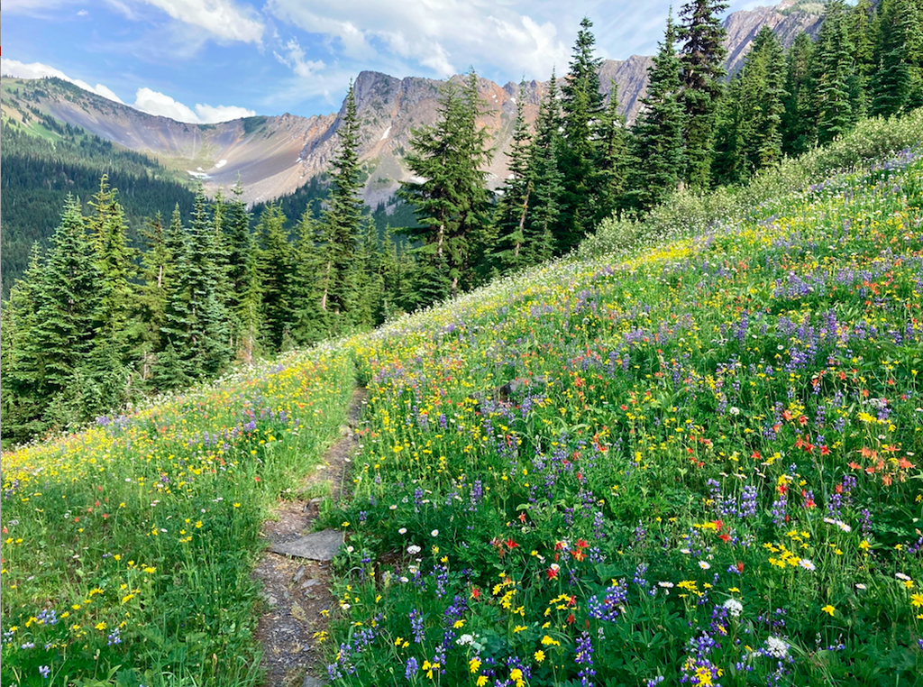
The Jackita Ridge trail is a stunning walk high in the western Pasayten Wilderness. With views of Crater Mountain and Jack Mountain, the ridge reaches at or above the timberline, giving hikers spectacular views all around. This trail is often used as part of the Devil's Dome loop or to reach Crater Mountain. The climb to the top of the ridge is steep and long, but the views of wildflowers and meadows along the way and mountains from the top are well worth it. The trail usually melts out later than most other trails in the area, so be prepared to see some snow.

Begin the hike by spending the first 5 miles climbing to the hike's high point at 6800 feet, an 1800-foot net elevation gain. Once you reach the top, the trail levels out into what is known as McMillan Park. Here, there are campsites and horse feed, and ripe huckleberries in the summer to refresh you after the challenging ascent. Follow the ridge until Devil's pass, where there is a junction with the Devil's Ridge trail. Follow the trail right to continue on to Deception Pass, and left to reach Devil's Dome. This trail is also part of a system of trails that links to the Boundary Trail. If you are looking to connect to this trail, turn right at the fork.

This trail is part of WTA's Lost Trails Campaign. Learn more about how we're saving lost trails across the state here.

WTA worked here in 2018, 2017, 2015, 2012 and 2010!

Hike Description Written by
McKenzie Carlson, WTA Correspondent

Jackita Ridge

Map & Directions

Trailhead
Co-ordinates: 48.7060, -120.9250 Open in Google Maps

Before You Go

Wildfire: Trail closed from Devils Park north to the Pacific Northwest Trail

Highway 20 is closed from Ross Dam trailhead (milepost 134) to Early Winters (milepost 178) for the season.

See weather forecast

WTA Pro Tip: Save a copy of our directions before you leave! App-based driving directions aren't always accurate and data connections may be unreliable as you drive to the trailhead.

Getting There

From Winthrop drive State Route 20 west 55.1 miles, or 32.8 miles east from Marblemount, to the Canyon Creek Trailhead (near mile post 141). The parking area is on the left. A privy is available.

More Hike Details

Trailhead

North Cascades > North Cascades Highway - Hwy 20

Jackita Ridge (#738)

Okanogan-Wenatchee National Forest, Methow Valley Ranger District

Guidebooks & Maps

Green Trails Mt. Logan No. 49

You can improve or add to this guidebook entry

Jackita Ridge

60 Trip Reports

Hiked here recently?

Submit a trip report!
 
Trip Reports