

There are two routes to Kalama Falls. The longer forest trail is for hikers and horsemen, and the gravel road is for casual walkers and bikers. Both are easy to walk, with some elevation change, and both reach the same destination: Kalama River Falls.
The forest trail to Kalama Falls begins at the Kalama Horse Camp off Forest Road 81 (closed from December to March, though parking is available outside the camp). From this campsite, five Gifford Pinchot National Forest trails radiate. Take the Cinnamon Trail, which crosses the Kalama River on a wooden stock bridge and ascends along the bank of the river, heading east for a quarter mile to a primitive campsite.
At this site, the Kalama Falls trail begins south on an old two-track clay road. There is no signage, but take the only route heading south as the old road wends past a few dispersed camping sites. At the south end of the dispersed campsites, the route becomes a single track.
After a mile on the single track, the paved FR 81 is reached. Crossing the road, the trail parallels the river with a worthwhile spur to an overlook. For the most part, the tread is pumice, relatively flat, and traverses a replanted Douglas fir forest (ca. 1999) with little elevation change for 2 miles where it crosses a gravel road (#7500).
Remain on the footpath (and enter an older forest) as it passes pahoehoe-type lava formations. This smooth, stacked magma looks like layers of arrested molasses and flowed approximately 1,200 years ago, damming up a stream that created Merrill Lake.
At mile 3.5, the trail crosses road 7500 once again (near a concrete bridge) and enters an old-growth forest of Douglas fir and western redcedar. The falls are a quarter mile south on this footpath.
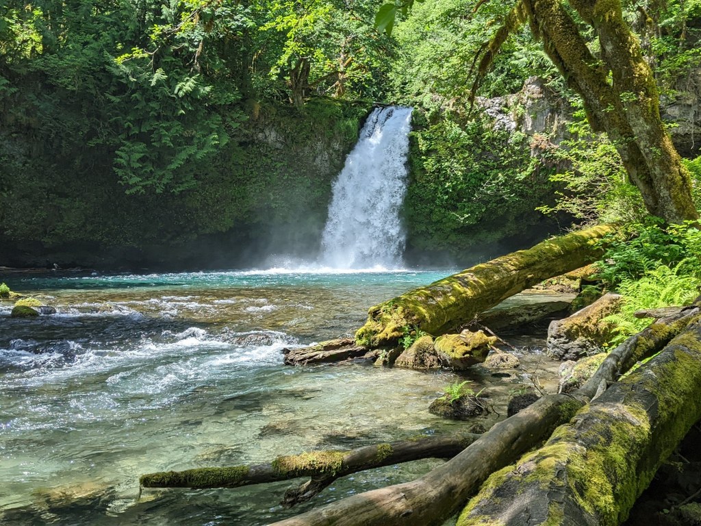
Kalama River Falls is a two-tiered, plunge-type waterfall, and a worthwhile destination viewed from two upper bank levels with an old-growth forest in the background. The geology suggests the lava ended here before it pushed further south, forming the north bank of the Kalama River downstream.
Beyond the falls, the Kalama River heads west as a wild and scenic river, eventually reaching the Columbia River. The falls are active year-round, and the river’s origin is spring-fed McBride Lake on the south slope of Mount St. Helens. The Merrill Lake stream that converges with the river at the bottom of the falls doubles the volume. The trails from the bluff overlooking the falls are primitive and difficult to traverse.
The Kalama River Falls and trails are public access and part of the 1,448 acres acquired by the Washington Department of Fish and Wildlife (WDFW) between 2015 and 2019. The WDFW does not maintain trails, so the forested paths are overseen by the Backcountry Horsemen of Washington. The longer forest trail spans two land managers: The Gifford Pinchot National Forest and the WDFW land bordering the east side of the river.
 Trailhead


