
Follow a clear path as it heads straight up the fall line of Keystone Ridge, but beware of loose gravel. The grade isn't terribly steep, but hiking poles would help to keep you from sliding down after each step. There is another path to the left of the one that heads up the ridgeline from the trailhead which is less steep, but is harder to follow.
After a little more than half a mile, stop to enjoy the view (and catch your breath) - you've just done 1100 feet of elevation gain! Take in the wide silver ribbon of the Columbia River and the rounded shoulders of the mountains around you.
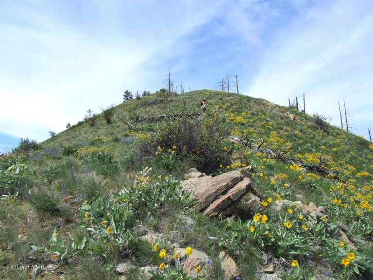
Closer in, take a look around your feet for wildflowers, and keep looking as you continue hiking. The flower show intensifies as you climb. The path fades in and out of visibility. When in doubt, refer to your map and follow the ridgeline.
The route follows the ridge as it goes over several stairsteppy humps. Hike along a flat section, then climb steeply and then come to a little downhill. Repeat. The views continue to improve as the horizon expands. At every step, you'll enjoy 360 degree views and near total solitude.
Be sure to bring plenty of water and sunscreen, since this is a dry route and very exposed, with only two trees about halfway up the route that provide minimal shade.
At the top there is a small building and tower that provide some shade. Take another rest; you've just done 3500 feet of elevation gain in 3.6 miles. That's a pretty good workout. Take the long and winding road down the hill, traversing at first and then dropping into the canyon and crossing a creek that runs across the road. This is your first water source on the hike, and nearby trees provide welcome, much-needed shade too.
The views are outstanding. The wildflower show is superb. The solitude can be total. The wildlife is out -- look out for birds above and rattlers in the grasses!
Keystone Ridge

-
 Length
- 8.4 miles, roundtrip
Hike up a steep, dry ridgeline in the Entiat with 360 degree views of the Columbia River, the wine country of eastern Washington, and wildflowers galore.
Continue reading
Hiking Keystone Ridge
Map & Directions
 Trailhead
Before You Go
WTA Pro Tip: Save a copy of our directions before you leave! App-based driving directions aren't always accurate and data connections may be unreliable as you drive to the trailhead.
Getting There
From highway 97: Turn left towards Entiat and drive several miles to the Mills Canyon Road. Here the pavement gives way to dirt. Continue on for about three miles until a creek crossing. Park here to hike up the road to Keystone Point. Or, leave one car here and head back out to Highway 97 and drive south for a mile to a large turnout where you can park and start the hike for the ridgeline.


