Trails for everyone, forever

Home Go Hiking Hiking Guide Klapatche Park
link

Klapatche Park

Mount Rainier Area > NW - Carbon River/Mowich
46.7354, -121.8566 Map & Directions
Length
21.4 miles, roundtrip
Elevation Gain
3,300 feet
Highest Point
6,000 feet
Calculated Difficulty About Calculated Difficulty
Hard
Photo by trip reporter Lisa Elliott. Full-size image
  • Wildflowers/Meadows
  • Mountain views
  • Wildlife
  • Established campsites
  • Lakes
  • Rivers

The Wonderland Trail has been described as magical, hiking through a wispy-clouded August sky to the many glaciers, river valleys and high alpine meadows all while traveling through the through Rainier's backcountry. Klapatche Park will give you a chance to experience the Wonderland Trail with only 21 miles of hiking. Continue reading

Rating
4.00 out of 5

(5 votes) Log in to rate

Hiking Klapatche Park

Experience one of the best wilderness camps on the Wonderland by sneaking in the back way! From the end of the Westside Road, walk the road-turned-trail for 8 miles to the St. Andrews Creek Trailhead.

From there, it’s a 2.6-mile jaunt to connect to the Wonderland and just a short distance farther to Klapatche Park.

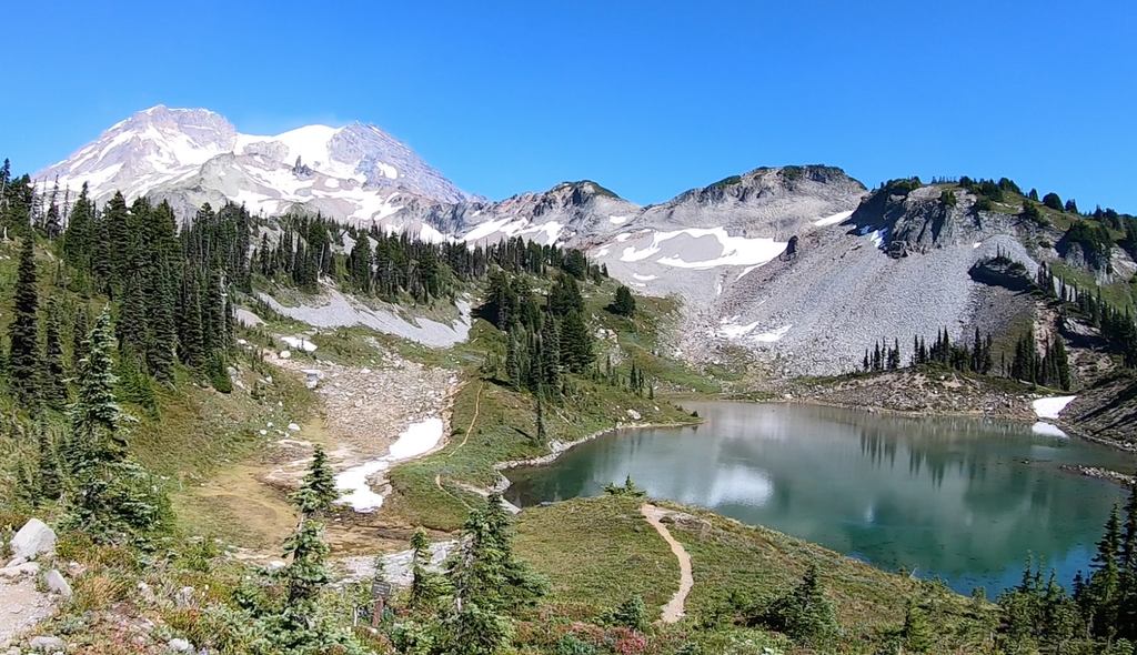
While there, find the calm of the backcountry by wandering down the trail towards St. Andrews Park, experience the eye popping scenery at the base of the Tahoma Glacier or just relax in the sun on the shores of St. Andrews Lake.

Hike Description Written by
Tami Asars, WTA Correspondent

Klapatche Park

Map & Directions

Trailhead
Co-ordinates: 46.7354, -121.8566 Open in Google Maps

Before You Go

See weather forecast

WTA Pro Tip: Save a copy of our directions before you leave! App-based driving directions aren't always accurate and data connections may be unreliable as you drive to the trailhead.

Getting There

From the Nisqually entrance of Mount Rainier National Park (off Highway 706), drive east on Nisqually-Longmire Road for one mile. The turnoff for the Westside Road is on your left. There is no designated parking area, so be sure to park in such a way that traffic can flow uninterrupted along the road.

More Hike Details

Trailhead

Mount Rainier Area > NW - Carbon River/Mowich

Mount Rainier National Park

Guidebooks & Maps

Hiking the Wonderland Trail (Asars - Mountaineers Books)

You can improve or add to this guidebook entry

Klapatche Park

25 Trip Reports

Hiked here recently?

Submit a trip report!
 
Trip Reports