
This hike is a nice, long road walk leading to a trail, a good alternate to the Klickitat Rail Trail for a change of scenery.
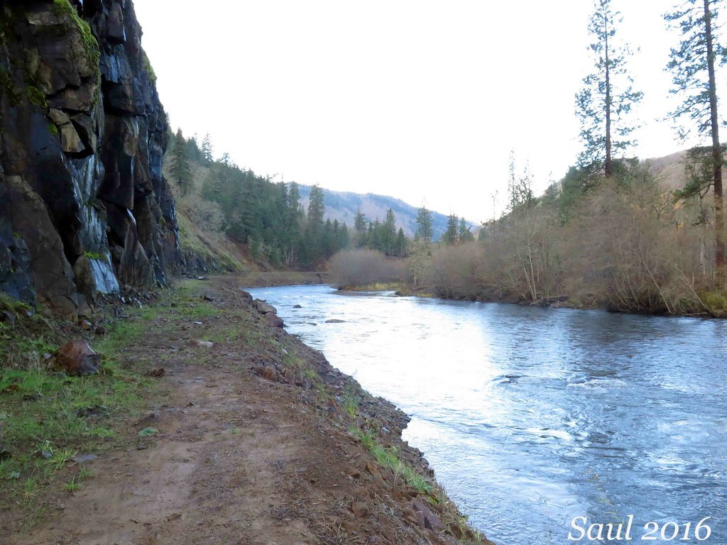
The longest undammed river in Washington state, the Klickitat River featured a logging railroad along the west bank, built in the early 20th century. It was then converted to a two-lane paved private log haul road in the 1950s. After Champion Lumber Company closed its mill in Klickitat in 1994, the road was abandoned. The February 1996 flood washed out sections of the road, making it impassable to vehicles. In 2007, Columbia Land Trust purchased the road right-of-way and began a fish habitat restoration program to remove the asphalt and restore the river bank to bring back salmon and steelhead habitat. Now, the former road corridor is open to the public for hiking and mountain biking.
The first two miles of the hike are on asphalt, then the pavement ends and turns to gravel for another one eighth of a mile or so before the restoration begins. The road bed has been pulled back, culverts removed and the slope of the river bank restored to allow the river to flow freely. There is a six to ten-foot wide shelf along cliffs -- this is the trail surface. In other stretches where there aren't cliffs and the road bed is back from the river, the route is on the former road now converted to dirt.
After the first 1.5 miles of the hike, Highway 142 on the east bank turns away from the river. From that point on, traffic sound fades and the only noise is the rushing water and the calls and songs of birds. In autumn and winter, you may see bald eagles or spawning salmon, since the Klickitat River is a major gathering place for wintering bald eagles feeding on salmon carcasses.
At 3.5 miles, the route reaches a backwater against a cliff about three feet deep. This is a good turnaround point; otherwise, the river must be waded in order to continue north.
Klickitat Haul Road

-
 Length
- 7.0 miles, roundtrip
-
 Elevation Gain
- 825 feet
-
 Highest Point
- 825 feet
Parking Pass/Entry Fee
None
This hike is a nice, long road walk leading to a trail, a good alternate to the Klickitat Rail Trail for a change of scenery.
Continue reading
Hiking Klickitat Haul Road
Klickitat Haul Road
Map & Directions
 Trailhead
Before You Go
Parking Pass/Entry Fee
NoneWTA Pro Tip: Save a copy of our directions before you leave! App-based driving directions aren't always accurate and data connections may be unreliable as you drive to the trailhead.
Getting There
Find the trailhead by driving north from Lyle on SR 142 through the town of Klickitat. Continue about 6 miles. Just before the highway crosses the Klickitat River, look for a break in the guardrail giving access to a paved road on the left. You can drive in a few hundred yards and park at a metal gate.


