

The popular Latourell Falls in Guy W. Talbot State Park offers hikers several loop options, a family friendly one-mile roundtrip accessible walk to the Lower Falls and historic bridge, or a 2 mile loop to also take in the 134-foot Upper Falls, the third tallest in the Columbia Gorge.
This route combines them both for a 3 mile loop that saves the flatter meander through the southern picnic area, bridge, and Lower Falls for the end of the hike. Start this loop to the left of the trailhead map and sign, in the main trailhead parking area to the east.
First stop, the Upper Falls. The trail begins an immediate moderate uphill, travelling past two bench and viewpoints in the first 0.5 mile. A short set of switchbacks begins shortly after and after, a large log and wide sitting area beckon for a quick break.
At just under one mile, reach the two-tiered Upper Falls. Admire the almost hidden top drop behind a large rock formation as you feel the waterfall spray crossing the bridge to the other side to begin the trek along the other side of the creek.
The trail continues slightly uphill and about a half a mile from the Upper Falls, look for the trail marker to stay left at a Y-intersection. Enjoy another opportunity to rest on a bench with a view, although, the Gorge’s weather might not make seeing anything possible other than the trees directly in front of you!
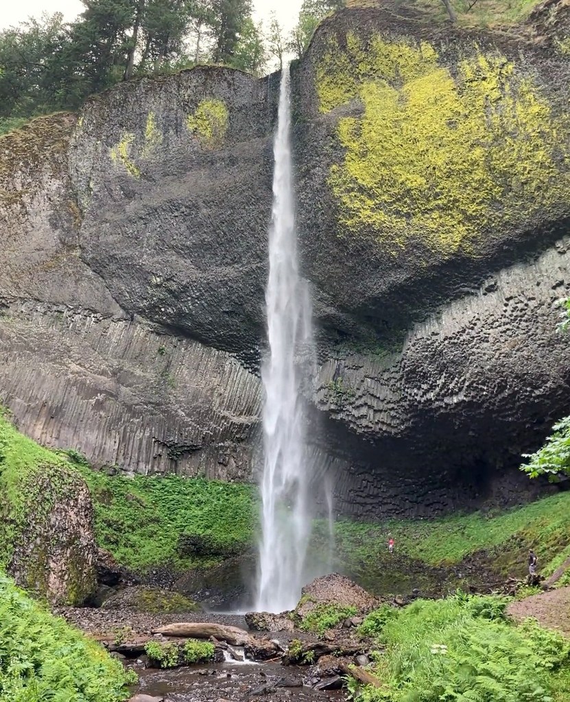
Continuing along the trail’s descent, at about a mile from the Upper Falls, cross the Historic Columbia River Highway past the western alternate trailhead parking to the stairs down to the picnic shelter area. Keep to the right to follow the accessible trail underneath the 1914 historic highway bridge and approach Lower Latourell Falls.
This 225-foot waterfall streams over columnar basalt and you’ll again have the opportunity to feel the waterfall spray as you cross the creek’s footbridge. Head back up the path to complete the loop and return to the eastern parking lot.
 Trailhead


