
A tough route through spectacular scenery.
For an abandoned trail, the Leroy Creek Trail is in remarkably good condition. It begins at a junction, which may or may not be signed, with Rock Creek Trail No. 1509 just before it makes the final ascent to a saddle south of Carne Mountain. The trail immediately crosses a pass to the east of Carne and begins a long descent into the headwaters of Box Creek. At the crossing of a fork of Box Creek, the tread abruptly disappears, but the route goes straight up a meadow on the far side of the stream to where the trail resumes. This meadow has a few camp sites at its lower end, with water throughout the summer.
After climbing up to another meadowy basin on the northern fork of Box Creek, the trail turns abruptly west, then disappears again. At this point, the best route is to ignore the disconcerting segment of trail altogether and instead to hike up toward an obvious pass at the creek's head. The pumice barrens at the pass serve as a spectacular camp-site, and water is available just below the pass. The trail again appears on the north side of the pass, dropping down to Chipmunk Creek, where it fades away yet again. As before, climb up to the pass at the head of the basin.
The next segment of trail is perhaps the most dangerous of the whole route. There are two main options for crossing the next cirque: slide a thousand feet straight down the scree and pick up the trail on the basin floor, or follow a climbers' track up to a pass above the Ice Lakes. At this point, one can hike down to Upper Ice Lake or follow a similar track the rest of the way across the scree and down a dusty ridge to the trail. Along this portion of the trail, it is very helpful to have a pair of trekking poles, or perhaps an ice axe early in the season.
From the junction of the upper and lower routes, the trail switchbacks down into the headwaters of Leroy Creek, skirting above and below cliffs and buttresses. At the bottom, the tread is obscured by recent rockfall and washouts, but a few cairns lead downhill to a portion of the original trail which goes down and across one of the streams forming Leroy Creek. From here, hikers must cut straight across the slope until they reach the brink of a nasty washout in the midst of the largest boulder field. Scramble routes exist at both the upper and lower ends of this gully, but the lower one is probably easier and safer, especially when the upper end is filled with snow and ice. More cairns guide the way to the far side of the rocks, where the tread picks up again.
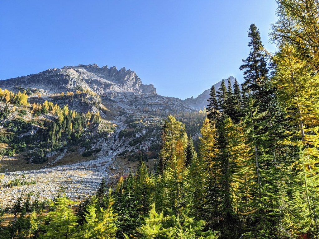
This part of the tread appears to get more use than the others, and continues uninterrupted down to the Phelps Creek Trail No. 1511. There are several large campsites in Leroy Basin and just below it along the creek. Leroy Basin itself is a spectacular spot, with scree and cliffs rising 3000 feet above to the craggy summits of Seven-Fingered Jack.
Below the basin, the trail becomes well-traveled, steep, and incredibly dusty. The last eruption of Glacier Peak dumped at least two feet of ash on this area, and it hasn't gone away. It tends to swirl about the feet of passing hikers, turning their boots to chalky white. The trail climbs down past Leroy Creek Falls and emerges onto the Phelps Creek Trail, unsigned except for the obvious: "Trail Not Maintained".
Leroy Creek High Route

A tough route through spectacular scenery.
Continue reading
Hiking Leroy Creek High Route
Leroy Creek High Route
Map & Directions
 Trailhead


