

Lime Kiln State Park is one of the more scenic spots on an already beautiful island. Sometimes called “Whale Watch Park,” it is not uncommon to see Orcas or other marine life playing in the water as you wander along the rocky edges of the Salish Sea. The hike described here provides plenty of opportunity for spotting killer whales, while also allowing you to explore the upland environment and see the historic lime kiln.
Find the Upland Trail leaving from the north end of the main parking lot. Start climbing away from the lot. Most visitors will likely be heading towards the water. Don’t worry, you will return to the lighthouse and whale watching site on your way back! For now, head for the relative solitude of the Upland Trail.
As you ascend, you’ll pass several unmarked paths leading off to the right, towards the Land Bank Preserve. Ignore these and continue on the main trail, as it eventually drops down a winding hill before passing a water tower on your left. At 0.4 miles, reach a signed three-way junction, with trails leading to the parking lot, the lighthouse, and the lime kiln.
Follow the trail towards the lime kiln, pausing at a small overlook to get a bird’s eye view of the kiln and read some interesting facts about the once thriving lime industry. Continue on to the kiln itself, descending steep stairs on your left to the water’s edge, where a couple of picnic tables provide a great spot to enjoy lunch or simply listen to the water burble against the rocks.
Don’t forget to cast your eyes skyward for eagles soaring above, and seaward for orcas. After exploring the kiln site, return to the three-way intersection mentioned above, and this time turn right, heading towards the water and the lighthouse
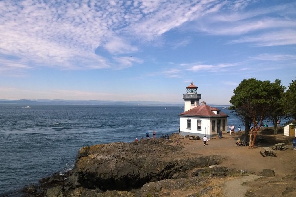
About 0.8 miles into your hike, you will see a short signed trail to your right. This leads to the lighthouse, a prime whale watching spot complete with a whale listening station. Explore the lighthouse before continuing along the gravel path immediately adjacent to the water. Admire the madrona trees, but please don’t carve into them — it can damage them and doesn't follow Leave No Trace guidelines. Don’t forget to occasionally glance behind you for more lighthouse views.
Follow the rocky shoreline south, keeping a keen eye on the water for marine life. At 1.15 miles, you’ll reach an intersection with the trail to Deadman Bay. Go right for more distance (0.6 miles RT), or head slightly left up the wide gravel trail back to the parking lot.
WTA Pro Tip: Quite scenic, the short trail to Deadman Bay is highly recommended, although not with small children due to the narrow trail along steep rocky outcroppings. It hugs the shoreline and offers even more views and chances to see whales.
 Trailhead


