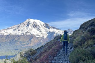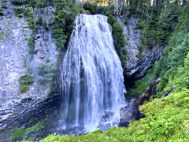

The Longmire to Paradise section of the Wonderland is a terrific combination of strenuous and cushy hiking, with a series of lovely waterfalls — Carter, Madcap, and Narada — thrown in for good measure.
Park in the giant Longmire Information Center parking lot with flush toilets and walk across the lot to the Wonderland Trail sign near the museum. It's wide and well-maintained as you head east, staying under beautiful old-growth canopy for two miles, and come out at a roadside viewpoint overlooking the Nisqually river. Following the sign to your right, go down the small hill to the riverbed.
Off to your right a few hundred yards you'll see a log bridge crossing a narrow bit of the river. There's a fairly well-marked path over to the bridge through the wide boulder-strewn river bed, marked by cairns, so you're walking mainly on sand, not rocks. Cross the sturdy bridge and continue to your left. The path is a little more faint here, but you can't get lost since you can always look back and see the bridge.
The trail re-enters the forest in another hundred yards or so, climbing parallel to the river but now more steeply upwards, though still on smooth, wide trail. You'll come to Carter Falls, then Madcap Falls, then the unbelievably beautiful, huge Narada Falls. Continue upwards, crossing the road to pick up the trail and continue to Paradise. When the trail ends, cross the road to the Visitor's Center for lunch. Return the way you came.
Longmire to Paradise

-
 Length
- 12.0 miles, roundtrip
-
 Elevation Gain
- 2,700 feet
-
 Highest Point
- 3,600 feet
Hike on the Wonderland Trail to three waterfalls on the Paradise River.
Continue reading
Hiking Longmire to Paradise

WTA worked here in 2019 and 2018!
Map & Directions
 Trailhead
Before You Go
Parking Pass/Entry Fee
National Park PassWTA Pro Tip: Save a copy of our directions before you leave! App-based driving directions aren't always accurate and data connections may be unreliable as you drive to the trailhead.
Getting There
Learn how to secure your timed-entry permit for Mount Rainier National Park here.
From I-5, take exit 143 for S 320th St toward Federal Way. Stay in the left 2 lanes to turn left onto S 320th and proceed for 0.8 miles. Turn right onto Military Road S and drive for 4.4 miles, then turn left onto WA-161 S and proceed for 3.9 miles.
Get into the two left-hand lanes, and turn left onto WA-167 N toward WA 410, then take the exit for 512 W toward 161 S. Proceed on 512 W for 2.5 miles, then exit for South Hill. Follow the signs for 161S/Eatonville/Mount Rainier.
Stay on 161 S for 22.6 miles, then turn left onto Center St. E, into Eatonville. Continue onto Alder Cutoff Road E for 6.5 miles, then at a 'T' intersection, turn left onto WA-7 S. Drive through the tiny town of Elbe and continue along Hwy 706, which becomes the Paradise Road when you enter the park. Longmire is about 25 miles from the 'T' intersection before Elbe.