

This is a great all-season hike featuring beautiful mature second growth forest and beach access. Hike down a lushly forested ravine with a babbling creek, home to many species of salmon and trout. Follow the creek to its estuary as it empties into Puget Sound. If you extend your hike to the beach, breathe in the serene panorama of Brown’s Bay, Puget Sound, the islands, and the Olympic Mountains. Watch the seabirds and go beachcombing to look for crabshells, anemones, and other treasures.
Take the broad trail from the trailhead at the parking lot down past the small lawn and enter open alder forest with salmonberry understory, then mature Douglas fir forest. The wide dirt trail can easily handle the traffic for this popular trail. Soon, it starts to descend sharply, losing almost 400 ft of elevation in 0.5 miles. The descent is facilitated by an 85-step staircase built into the hillside by WTA in 2017.
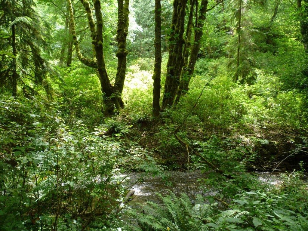
Despite this park’s location in the city of Lynnwood, it is an oasis of native forest vegetation – only closer to the beach do you see some ivy and other invasives.
At the bottom of the staircase you start hearing Lunds Gulch Creek. It is named after John Lund, who homesteaded here in 1878. Enjoy looking at the play of the water over the rocks. Very soon, you pass the 0.5 mile sign. The trail levels out and follows closely along the creek. Forest is now open mixed forest with bigleaf maple, Western redcedar, Sitka spruce, and a salmonberry understory. Note the impressive stumps of old growth Western redcedar that were left from logging, with the lumberjacks’ springboard notches still showing. Closer to the beach, the forest becomes alder forest with fern understory.
At 1 mile you reach a fork in the trail. Go left over the bridge and take a peek into the stream below to see if you can see any fish. Salmon come to spawn in the fall, and Chinook salmon, Coho salmon, steelhead, cutthroat trout, and sculpin have been observed in this stream. Then walk on past the Ranger station to a field with a covered picnic area, volleyball field and privy. Enjoy the first views of the Olympic mountains whose tops are visible even above the elevated railroad tracks at the end of the field. When you get to the far end of the field, you will see a tunnel passing under the railroad, permitting Lunds Gulch Creek to empty into Puget Sound. You can walk through the tunnel to the beach over a grate installed across the creek. In winter, especially after heavy rain, the creek may rise high enough to brim over the grate. Wear waterproof hiking boots for this hike so you can enjoy the foray to the beach.
Once you are on the beach, enjoy sitting on the logs taking in the views. Looking northwest across Puget Sound, you can see the white bluffs of the southern tip of Whidbey Island. Looking southwest, you see the green Kitsap Peninsula, and through the strait between Kitsap and Whidbey Island, the landmass of the Olympic Peninsula forms a sliver on the horizon. To the south are the headlands that define the southern end of Brown’s Bay. The Olympic Mountains tower over the landscape to the west. Watch for ferries smoothly gliding across Puget Sound in their inimitable way. You may also see a train passing, always an exciting sight. Then look more closely at Lunds Gulch Creek and how it winds through its small estuary, which is changing shape over the years, depending on the interplay between the tides, water flow variations from the creek, and sediment deposition. Watch for heron and osprey using their very different feeding strategies to benefit from the Sound’s bounty.
After enjoying the beach, go back through the tunnel and turn left onto the trail on the other side of the creek from the lawn area.This allows you to loop back through forest to the fork at the 1 mile point and continue on straight to return to the trailhead for a total 2.5 mile round-trip hike.
WTA Pro Tip: Do not cross the railroad tracks. You would be endangering yourself and others, and would also risk fines levied by BNSF police, for illegal trespassing on private property.
Extending your hike
At low tide, you may be able to walk along the beach as far south as the disused Haines Wharf, which adds about 1 mile round-trip to the hike. At very low tides, it may also be possible to walk north as far as Sunset Wharf, which adds 0.7 mile roundtrip. Be careful, though, to monitor the tide. Look at the level of the marine vegetation and barnacles on the exposed rocks as signs of the high tide level. Determine whether you would be able to return safely if the tide returned, without walking on the rail embankment, which is unsafe and not permitted. If you are lucky enough to be there at low tide, beachcombing is a treat – don’t miss seeing the purple sea anemones hiding at the base of big rocks on the landward side.

 Trailhead


