Trails for everyone, forever

Home Go Hiking Hiking Guide Luther Burbank Park

Luther Burbank Park

Puget Sound and Islands
47.5890, -122.2270 Map & Directions
Length
3.0 miles, roundtrip
Elevation Gain
120 feet
Highest Point
120 feet
Calculated Difficulty About Calculated Difficulty
Easy
Lakeside trail. Photo by Taum Sauk. Full-size image
  • Wildflowers/Meadows
  • Dogs allowed on leash
  • Good for kids
  • Lakes
  • Fall foliage
  • Coast

Parking Pass/Entry Fee

None
Saved to My Backpack

Luther Burbank Park is a waterfront park at the North end of Mercer Island, offering three miles of family- and pet-friendly trails with waterfront access, wetlands, and recreational activities. Continue reading

Rating
3.00 out of 5

(5 votes) Log in to rate

Hiking Luther Burbank Park

Luther Burbank Park is a waterfront park at the North end of Mercer Island, offering three miles of family- and pet-friendly trails with waterfront access, wetlands, and recreational activities. The park covers 77 acres, also including a children's play area, restrooms, an off-leash dog area, tennis courts, fishing piers, beaches, earthwork sculpture, and picnic areas.


The park grounds were originally home to the Calkins Hotel in the late nineteenth century. The area next became the site of a private school teaching farm work and study. It has also housed the administrative offices of the King County Park System. The City of Mercer Island purchased the site in 2003.

The park has a mix of paved and unpaved trails, mostly in the north-south direction. From the south parking lot, head north along the trail, past The Source, a spiral earthwork sculpture by John Hoge. The pathways will take you past playgrounds and dog play areas to Calkins Point, at the north end of the Island. Near Calkins Point, to the west, are wetlands.

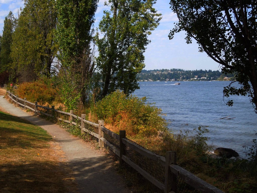
Returning south, follow the trail that takes you to the shore (near the off-leash dog area) along an unpaved path, with views of Beaux Arts. Continue past the fishing piers, through forest, to the beach area. Along the way, enjoy the sights of mixed evergreen and broadleaf forest, and the many Himalayan blackberry bushes--a creation of the amateur botanist Luther Burbank. There will be almost no thigh-burning here--the total elevation change from shore to maximum altitude is 120 feet--but there will be many opportunities for lakeside views and (somewhat) quiet reflection.

Hike Description Written by
Maxwell Krem, WTA Correspondent

Luther Burbank Park

Map & Directions

Trailhead
Co-ordinates: 47.5890, -122.2270 Open in Google Maps

Before You Go

See weather forecast

Parking Pass/Entry Fee

None

WTA Pro Tip: Save a copy of our directions before you leave! App-based driving directions aren't always accurate and data connections may be unreliable as you drive to the trailhead.

Getting There

From I-90 heading east, take the 77th Ave SE exit 7A immediately after the 2nd tunnel, and turn left on 77th Ave SE. Turn right at the stop sign onto N Mercer Way, go through the light at 80th Ave SE. Turn left onto 81st Ave SE. Turn right on SE 24th St. and drive to the end. The park entrance is on your left.

From I-90 heading west, take the Island Crest Way exit 7. At top of the ramp, turn right onto SE 26th St. At the stop sign turn left onto 84th Ave SE and drive straight into the park after another stop sign at SE 24th St.

take transit

This trailhead is accessible by bus! Plan your visit by bus using TOTAGO, or consult the schedule for King County Metro route number 204 and Sound Transit route numbers 505 and 554.

More Hike Details

Trailhead

Puget Sound and Islands

City of Mercer Island

You can improve or add to this guidebook entry!

Luther Burbank Park

31 Trip Reports

Hiked here recently?

Submit a trip report!
 
Trip Reports