Trails for everyone, forever

Home Go Hiking Hiking Guide Maplewood Heights Park

Maplewood Heights Park

Puget Sound and Islands > Seattle-Tacoma Area
47.4736, -122.1164 Map & Directions
Length
1.25 miles, roundtrip
Elevation Gain
300 feet
Highest Point
500 feet
Calculated Difficulty About Calculated Difficulty
Easy
An autumnal walk in the woods. Photo by Shelly Sundberg. Full-size image
  • Dogs allowed on leash
  • Fall foliage
  • Good for kids

Parking Pass/Entry Fee

None
Saved to My Backpack

Short forested lollipop trail in the Renton Highlands that crosses a creek and has several access points. Continue reading

Rating
0.00 out of 5

(0 votes) Log in to rate

Hiking Maplewood Heights Park

Starting out at SE 144th St and 168th Ave SE, the first leg of this unmarked trail runs parallel to a private driveway but provides a narrow forested oasis. The trail heads straight north for a quarter mile and turns left (just before reaching the Liberty High School tennis courts), then descends steeply (but briefly) to a creek. If the creek is running too high to cross, take the path to the right, where there is a dry earth bridge over the creek culvert. Climb up a short ways to a three-way intersection. To do the loop, head right and stay to the right (there are some short access trails and a few boot trails branching off from the main loop) until you complete the loop and come back to this intersection. The first part of the loop abuts the athletic fields of Liberty.  

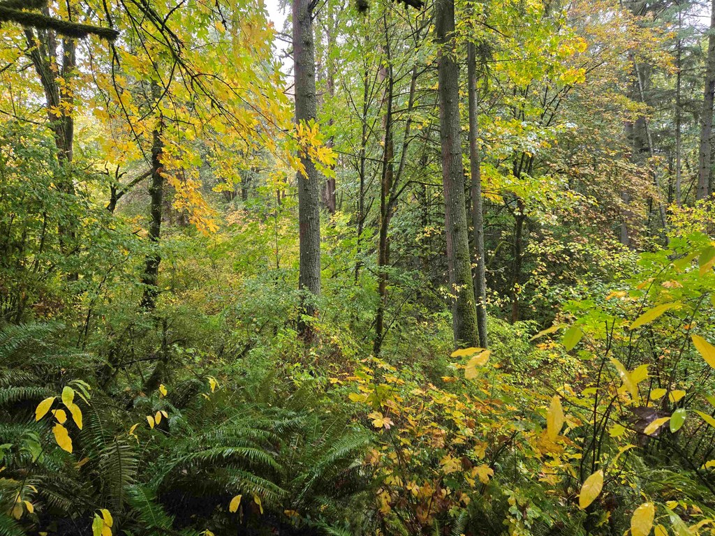
The forest features mature maples, alders, Douglas-firs, and an occasional western red cedar. There are also abundant Indian plum, snowberry, red huckleberry, sword and bracken ferns. It’s a colorful show in the fall.

There are at least five access points to this short trail, none of which are signed: the one described in the driving directions, three entrances along 164th Ave SE between SE 139th Pl and SE 142nd St, and one entrance (but no parking) just west of the intersection of 169th Ave SE and SE 140th St.

Toilet Information

  • No toilet at trailhead

More information about toilets

Hike Description Written by
Shelly Sundberg, WTA Correspondent

Maplewood Heights Park

Map & Directions

Trailhead
Co-ordinates: 47.4736, -122.1164 Open in Google Maps

Before You Go

See weather forecast

Parking Pass/Entry Fee

None

WTA Pro Tip: Save a copy of our directions before you leave! App-based driving directions aren't always accurate and data connections may be unreliable as you drive to the trailhead.

Getting There

From I-405 northbound or southbound, take exit 4 and head east on Hwy 169. Go 3.1 miles and turn left on 154th Pl SE. Go 0.9 mile and turn right on 156th Ave. SE. Go 0.1 mile, and turn left onto SE 144th St. Go 0.7 mile to the intersection of SE 144th St and 168th Ave SE. On the north side of this intersection, there are signs that show these two streets and also say Maywood Middle School. The unmarked trailhead is immediately to the right of these signs.

There is no parking lot. There is street parking along SE 144th St or 167th Ave SE. 

More Hike Details

Trailhead

Puget Sound and Islands > Seattle-Tacoma Area

King County Parks

You can improve or add to this guidebook entry!

Maplewood Heights Park

0 Trip Reports

Hiked here recently?

Submit a trip report!
 
There aren't any trip reports for this hike yet.
Loading trip reports...