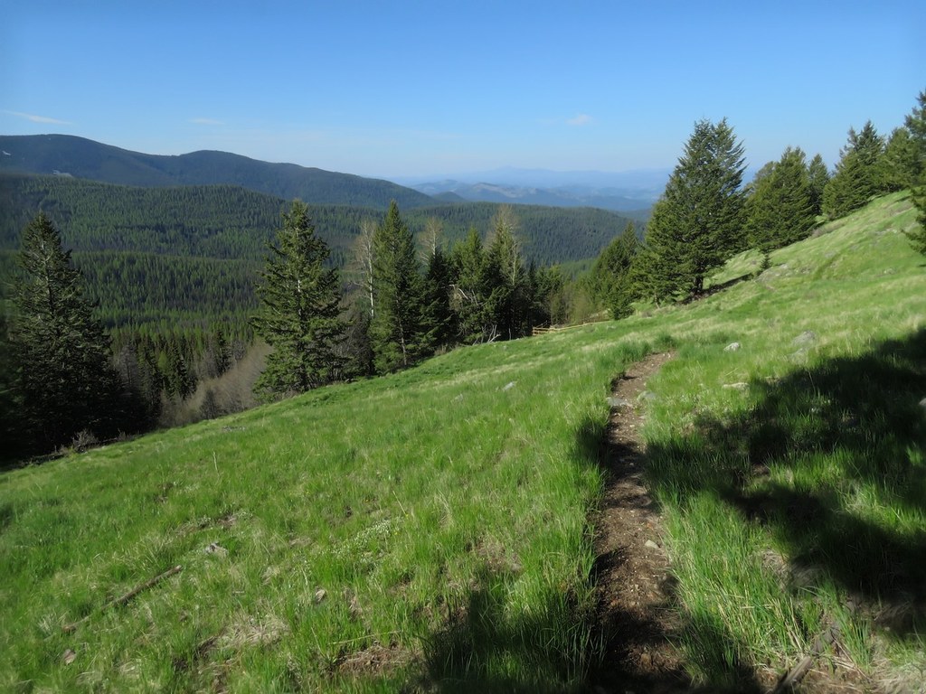

The Marcus trail starts about 18 miles east of the town of Republic in the Colville National Forest. Starting out for the first 1.5 miles on an old road, this trail gradually climbs until meeting up with the Kettle Crest Trail.
Along the way, the trail crosses through patches of forest and open meadows where you’re likely to spot wildflowers and wildlife. You’ll arrive at the intersection of the Kettle Crest Trail and have the choice to continue on. It’s about equidistant to Copper Butte (north) and Scar Mountain (south). The trail crosses over the summit of Copper Butte, while only skirting around the base of Scar Mountain.
Marcus Trail

-
 Length
- 3.5 miles, one-way
-
 Elevation Gain
- 1,760 feet
-
 Highest Point
- 6,440 feet
The Marcus trail starts about 18 miles east of the town of Republic in the Colville National Forest. Starting out for the first 1.5 miles on an old road, this trail gradually climbs until meeting up with the Kettle Crest Trail.
Continue reading
Hiking Marcus Trail
Marcus Trail
Map & Directions
 Trailhead
Before You Go
Parking Pass/Entry Fee
NoneWTA Pro Tip: Save a copy of our directions before you leave! App-based driving directions aren't always accurate and data connections may be unreliable as you drive to the trailhead.
Getting There
From the town of Republic, head east on Highway 20 for about 2.5 miles, then turn left onto Highway 21 for another 0.8 mile. Turn right onto Old Kettle Falls Road for 2.4 miles, then turn left onto Jack Mays Pride Road for 0.8 miles, reaching an intersection where you’ll stay straight on Forest Road 2152 for another 3.8 miles. Turn left onto Forest Road 2040/Timber Ridge Road for 2.0 miles, then turn left to stay on this for another 3.2 miles. Turn right onto Forest Road 250 for another 1.4 miles, then the trailhead will be on your left.


