
This hike has deep forest, pretty mountain lakes, fall color, and plenty of good trail to walk on without watching your feet all the time.
The trail initially spends a brief time in the forest, then it crosses through an old clearcut, then heads back to forest, back to clearcut, and finally forest for the rest of the climb to Hope Lake. The first part of the climb is in a deep valley. It is followed by a moderate ascent through forest, and finally a steeper climb (1.3 miles, 1,000-foot elevation gain) to Hope Lake. In fall, vine maple will brighten this climb.
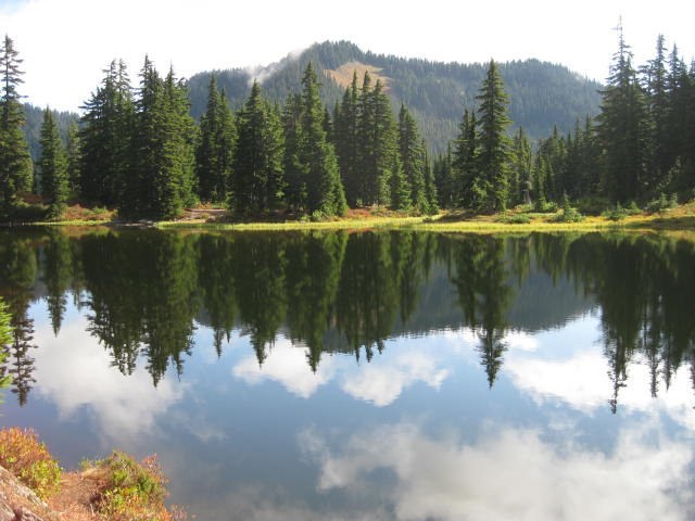
At Hope Lake, you’ll find places to enjoy a break, or to totally relax if this is your destination. Color is provided by blueberry bushes, but the berries will be gone fast, nibbled away by savvy fall crowds. To go to Mig Lake, a pretty lake in a flat, open setting, go left around Hope Lake on the Pacific Crest Trail for about 0.9 miles.
WTA Pro Tip: Turn right at Hope Lake and follow the PCT for 3.5 miles to Trap Lake. The trail to Trap Lake takes the PCT up over a pass at 5,300 feet and then down a bit before starting a long, gentle climb towards Trap Lake. The trail is open with outstanding views. Fall color is provided by the ever-present blueberry bushes and the reward is a wonderful view of Trap Lake.
Hope and Mig Lakes

-
 Length
- 5.0 miles, roundtrip
-
 Elevation Gain
- 1,550 feet
-
 Highest Point
- 4,650 feet
This hike has deep forest, pretty mountain lakes, fall color, and plenty of good trail to walk on without watching your feet all the time.
Continue reading
Hiking Hope and Mig Lakes
Hope and Mig Lakes
Map & Directions
 Trailhead
Before You Go
Parking Pass/Entry Fee
Northwest Forest PassWTA Pro Tip: Save a copy of our directions before you leave! App-based driving directions aren't always accurate and data connections may be unreliable as you drive to the trailhead.


