Trails for everyone, forever

Home Go Hiking Hiking Guide Mother Mountain Loop

Mother Mountain Loop

Mount Rainier Area > NW - Carbon River/Mowich
46.9328, -121.8632 Map & Directions
Length
15.3 miles, roundtrip
Elevation Gain
6,277 feet
Highest Point
6,380 feet
Calculated Difficulty About Calculated Difficulty
Hard

Mowich Lake Road is closed for the season

Flowers galore in Seattle Park. Photo by bentley-edelman. Full-size image

A popular route in the northwest corner of Mount Rainier National Park -- try this one as a day hike, an overnight (be sure to get permits first) or as a trail run! Continue reading

  • Wildflowers/Meadows
  • Ridges/passes
  • Established campsites
  • Mountain views
  • Dogs not allowed
  • Waterfalls
  • Lakes
  • Rivers

Parking Pass/Entry Fee

National Park Pass
Rating
0.00 out of 5

(0 votes) Log in to rate

Hiking Mother Mountain Loop

A popular route in the northwest corner of Mount Rainier National Park — try this one as a day hike, an overnight (be sure to get permits first) or as a trail run!

From the Mowich Lake Campground, walk alongside the southeast side of the lake, passing a small shelter before turning away from the lake and heading towards Knapsack Pass, 1.2 miles from the trailhead. Along the way to Knapsack Pass, you'll climb gradually and pass bootpaths leading to Fay Peak and First Mother Mountain.

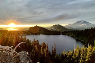
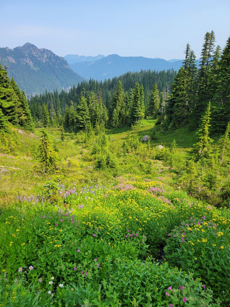
Descending out of Knapsack pass, meander through open meadows and pass more bootpaths, these leading to Mount Pleasant and a network of trails leading through Spray Park.

Though the trail here leads you around Spray Park, you'll get to traipse right through Mist Park and Seattle Parks; make time to enjoy the flowers and scenery here, especially if you're visiting in the spring.

After the parks, the trail descends to Cataract Valley Camp and on past a turnoff for the Carbon River Camp (permits required for both). Shortly past the Carbon River camp turnoff, you'll cross the Carbon River and link up with the Wonderland Trail briefly.

Turn left onto the Wonderland and hike for 1.1 miles, to another junction, this one with the Northern Loop Trail. Turn left again, staying on the Wonderland, cross the Carbon River (twice!) in half a mile, and then parallel the river along a trail at the base of a hillside for 1.7 miles to a junction where a right turn would take you to Ipsut Creek campground.

Stay on the Wonderland here for 3.4 miles, walking along a river valley and then climbing up to Ipsut Pass. In the pass, stay on the Wonderland (a right turn here would take you to Tolmie Peak). From the pass it's another 0.9 miles downhill to Mowich Lake and the trailhead.

Hike Description Written by
Anna Roth, WTA Staff

Mother Mountain Loop

Map & Directions

Trailhead
Co-ordinates: 46.9328, -121.8632 Open in Google Maps

Before You Go

Mowich Lake Road is closed for the season

See weather forecast

Parking Pass/Entry Fee

National Park Pass

WTA Pro Tip: Save a copy of our directions before you leave! App-based driving directions aren't always accurate and data connections may be unreliable as you drive to the trailhead.

Getting There

From Puyallup, drive east for 13 miles on Highway 410 to the small town of Buckley. Turn right onto Highway 165 and continue through Carbonado. You're looking for Mowich Lake Road, which is beyond the Carbon River Gorge bridge, right outside of town. Turn right onto Mowich Lake Road and follow it about 17 miles to its end. Note that this road is dirt, and can be rough. Consider bringing a high-clearance vehicle. The trailhead is on the left side of the road, near Mowich Lake.

More Hike Details

Trailhead

Mount Rainier Area > NW - Carbon River/Mowich

Mount Rainier National Park

You can improve or add to this guidebook entry

Mother Mountain Loop

8 Trip Reports

Hiked here recently?

Submit a trip report!
 
Trip Reports