

Mount Bonaparte, the tallest mountain in the Okanogan Highlands, dominates its corner of the world. The summit is 2500 feet higher than nearby Strawberry Mountain, and is 3700 feet higher than Bonaparte Lake.
A very fine loop hike is available that will take you all the way around the mountain, with a short dash to the summit lookout included. Once you have completely surrounded Bonaparte, you can claim your own Waterloo success.
From the trailhead (elevation 5078 feet), head east a short distance on possibly unmarked trail 307, the 4th of July Ridge trail. Soon reach a junction with the official route of the Pacific Northwest Trail (PNT). Turn left onto Cabin trail 303. You are now westbound on the PNT. Much of the next several miles go through old-growth western larch, beautiful in October.
Walk north for about 2.5 miles to a junction with the Antoine trail 304. The wreck of Napol Cabin is a little way to the left on the Antoine trail, which is the westbound route of the PNT. Turn right, shortly cross Antoine Creek on a sturdy bridge, and begin sidehilling up the slopes of Mount Bonaparte.
This route around the north side of Mount Bonaparte is considered an alternate route of the PNT. After a mile or so, the trail bends around to the right in a nearly 180 degree turn, and heads up a side ridge. This is the steepest climb of the trail, with around 1500 feet of elevation gain in two miles. Reach Bonaparte trail 306 about 3.5 miles after you turned onto the Antoine trail. Turn right on Bonaparte trail (really more of a 4WD road) and climb to the summit in about half a mile.
There are two lookouts on the summit, a new tower and an old cabin. The tower is still occasionally staffed. You can at least climb the stairs to get a huge view of the whole Okanogan Highlands. When you're done gawking, head back down the 4WD road, staying on the road past the Antoine trail junction, and proceed to lose all the 1500 feet you just gained.
Long past when it seems like you have descended too far, not quite two miles from the summit, reach the Southside trail 308 departing to the right. Take this trail and walk a mile to another junction, this one with the east end of the 4th of July Ridge trail 307. The Southside trail continues left, dropping first to the Pipsissewa trail and then to Bonaparte Lake in 5 miles.
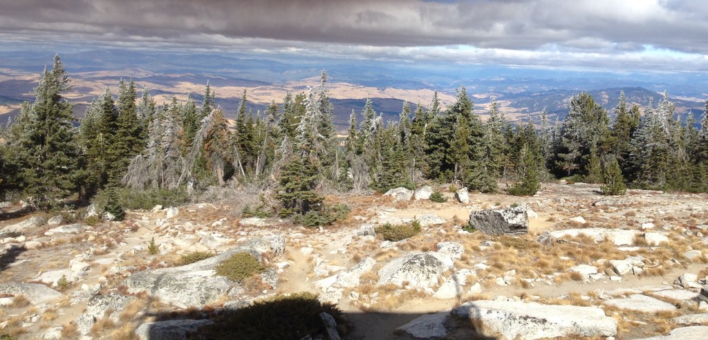
You turn right on the 4th of July Ridge trail, rejoining the official PNT route, and begin the wildest part of the journey. Climb around a ridge extending east from the summit of Mount Bonaparte, then travel around the south side of the mountain, with far-ranging views to the south.
You should be able to see Highway 20, some five miles away. Pass Lightning Spring, the first water on the trail since some springs near Antoine Creek. After 6 miles or so pass Roggow Cabin, in good shape and possibly inhabitable, then in another half mile come to the junction with the short trail left to your car at the 4th of July trailhead.
 Trailhead


