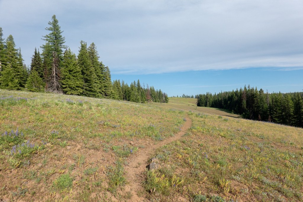

Despite the name, Mount Misery trail offers a delightful hike to the Oregon Butte Lookout, situated on a hilltop in the remote Blue Mountains.
Follow the Mount Misery trail to Oregon Butte, staying up on mostly open 5,000 - 6,000 foot ridges, enjoying panoramic views of the Blue Mountains. In spring, this hike is a great one for wildflower meadows dotted with scarlet gilia, dutchman's breeches, calypso orchid, sulphur lupine, giant-head clover, elkhorn clarkia, and more. In autumn, the changing of the seasons brings Roosevelt elk to the area.
As you climb, water is limited to scattered springs, snowpatches and a few small seasonal creeks -- so plan carefully and bring water along. The best water source is the Oregon Butte Spring, which is just below the lookout. Signs are missing or hard to find and trails get faint in places so a good map is crucial as well.
Mount Misery

-
 Length
- 16.0 miles, roundtrip
-
 Elevation Gain
- 1,000 feet
-
 Highest Point
- 6,401 feet
Despite the name, Mount Misery trail offers a delightful hike to the Oregon Butte Lookout, situated on a hilltop in the remote Blue Mountains.
Continue reading
Hiking Mount Misery

WTA worked here in 2019!
Map & Directions
 Trailhead
Before You Go
Parking Pass/Entry Fee
Northwest Forest PassWTA Pro Tip: Save a copy of our directions before you leave! App-based driving directions aren't always accurate and data connections may be unreliable as you drive to the trailhead.
Getting There
From Dayton, turn south on 4th St. Continue five miles, and turn left onto unpaved Hatley Gulch Rd. Proceed 4.4 miles to the end of this road, then turn right onto graveled Skyline Drive. Proceed six miles, then come to a sign indicating that Godman Springs is 12 miles to the right.
Turn right on this road and in one mile arrive in the Umatilla National Forest. Take a road branching off to the left. This road leads you 10.6 miles along one of the most scenic stretches of road in Washington. Finally, arrive at a fork in the road and take the left branch,FS-4608. Proceed 6.3 miles on this road to the Teepee Trailhead. At a three-way fork about the 4 mile in, take the right branch, which leads to TeePee trailhead.


