Trails for everyone, forever

Home Go Hiking Hiking Guide Mount Spokane State Park - Hay Ridge Loop
link

Mount Spokane State Park - Hay Ridge Loop

Eastern Washington > Spokane Area/Coeur d'Alene
47.8851, -117.0833 Map & Directions
Length
7.9 miles, roundtrip
Elevation Gain
1,690 feet
Highest Point
4,271 feet
Calculated Difficulty About Calculated Difficulty
Moderate/Hard
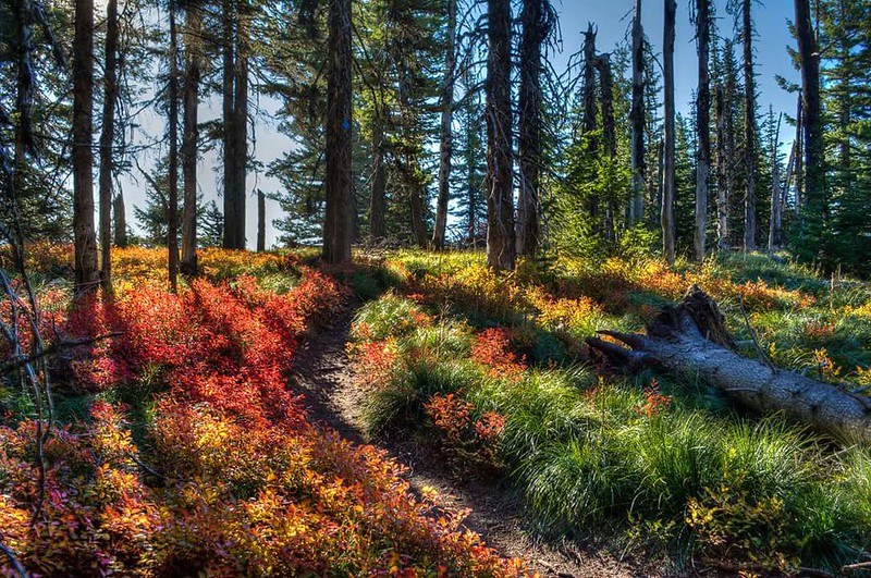
Fall at Mount Spokane State Park. Photo by Mark Ament.
  • Wildlife
  • Summits
  • Good for kids

Hike the Hay Ridge Loop on Mount Spokane to a warming hut that's a great option for a picnic in the summertime. Continue reading

Rating
0.00 out of 5

(0 votes) Log in to rate

Hiking Mount Spokane State Park - Hay Ridge Loop

Take Trail 110 up to where it crosses the Lower Mount Kit Carson Loop Road, and continue up to the intersection with Trail 100. Cross the creek on a new bridge built by WTA volunteers, and continue on Trail 100 as far as Smith Gap. A snowshoe hut is located here, though the Hay Ridge Loop makes for a loud hike in the winter, since it's open to snowmobiles. In summer, the hut may be open for picnickers!

From Smith Gap, continue up the hill to the intersection with Trail 170 for the Hay Ridge Loop Trail. This is a nice, shady route for hot summer days. There is quite a bit of vegetation growing in the trailbed on the first portion of the loop, but it is manageable. When Trail 170 meets Trail 140 the tread improves, because this section sees far more traffic.

After completing the Hay Ridge Loop, take the Mount Kit Carson Loop Road back down the hill to the Trail 110 intersection, and then head downhill back to the parking lot.

WTA worked here in 2013!

Hike Description Written by
Holly Weiler, WTA Correspondent

Mount Spokane State Park - Hay Ridge Loop

Map & Directions

Trailhead
Co-ordinates: 47.8851, -117.0833 Open in Google Maps

Before You Go

See weather forecast

WTA Pro Tip: Save a copy of our directions before you leave! App-based driving directions aren't always accurate and data connections may be unreliable as you drive to the trailhead.

Getting There

From Spokane, take Highway 2 north 10 miles. In Mead, go right (east) for 15 miles to Mount Spokane State Park.

More Hike Details

Trailhead

Eastern Washington > Spokane Area/Coeur d'Alene

Hay Ridge Loop (#170)

Washington State Parks

Guidebooks & Maps

http://www.mountspokane.org/

You can improve or add to this guidebook entry

Mount Spokane State Park - Hay Ridge Loop

2 Trip Reports

Hiked here recently?

Submit a trip report!
 
Trip Reports