Trails for everyone, forever

Home Go Hiking Hiking Guide Mount Spokane State Park - Entrance Loop

Mount Spokane State Park - Entrance Loop

Eastern Washington > Spokane Area/Coeur d'Alene
47.8878, -117.1261 Map & Directions
Length
1.6 miles, roundtrip
Elevation Gain
417 feet
Highest Point
3,570 feet
Calculated Difficulty About Calculated Difficulty
Easy
You can expect to see some funky mushrooms on trail in the right season. Photo by Holly Weiler. Full-size image
  • Dogs allowed on leash
  • Fall foliage
  • Good for kids
  • Old growth
  • Wildflowers/Meadows
  • Wildlife

Parking Pass/Entry Fee

Discover Pass, Sno-Parks Permit
Saved to My Backpack

This loop connecting Trails 120, 121 and 122 at Mount Spokane State Park is short and sweet, with enough elevation gain to make it a bit spicy, too! Continue reading

Rating
0.00 out of 5

(0 votes) Log in to rate

Hiking Mount Spokane State Park - Entrance Loop

Mount Spokane State Park’s Entrance Loop is often touted as a great introductory trail due to its relatively short distance at just 1.6 miles roundtrip. It starts just off the pavement at the first park trailhead beyond the ranger station, a shared trailhead with the bottom portion of Trail 110. The Entrance Loop is located on the east side of the main park road, and Trail 110 is accessed from the west side of the road.

This loop is best hiked counterclockwise. Despite the short distance for this loop, it is still considered at least somewhat moderate due to the way it climbs over 350 feet in the first half-mile, with some short sections approaching 15-20% grade.

Start by ascending Trail 122, then turn left at the junction with Trail 120. (Note: It is possible to turn right here instead and hike a short distance out-and-back on Trail 120, but this trail exits park property and enters Inland Empire Paper Company property after 0.7 mile.)

After continuing one-third of a mile on a relatively flat portion of Trail 120, turn left and head downhill on Trail 121 to complete the loop. (It is possible to continue uphill on Trail 120 to extend the hike. This portion of Trail 120 remains on park property following a former roadbed and eventually connects to the Lower Selkirk Trailhead.) Note that Trail 290 intersects and crosses the Entrance Loop on both Trail 122 and 121; this trail is a downhill-only mountain bike-specific trail, and therefore not open to hikers or equestrian use.

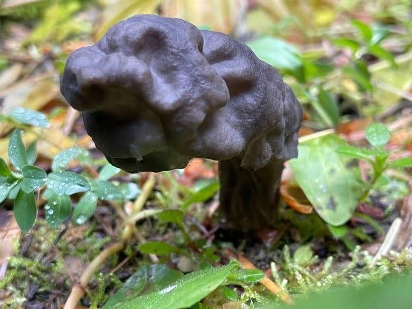
The Entrance Loop is perfect for someone looking for a short trail that provides a bit of a challenge through elevation gain. In the spring and fall, it is excellent for mushroom peeping. Spring also brings a carpet of wildflowers, with an abundance of arnica, Calypso orchid and wild ginger. Fall shows off the gorgeous changing colors of western larch and cottonwood along the route. In the summer, this is a great shady trail to escape the heat and enjoy the diverse forest. In the winter, the route is a short yet somewhat challenging snowshoe hike. Note that Trail 120 is groomed for snowmobile use when conditions allow, so snowshoe users might meet snowmobiles on that portion of the loop. Be sure to watch for western white pines along the route, including some of the largest specimens in the park.

Toilet Information

  • Toilet at trailhead
  • Accessible toilet

More information about toilets

Wheelchair Accessibility

The entire trail is a former roadbed. The trail entrance includes bollards that may be too narrow for easy access for some mobility devices. Portions of the trail include steep sections, and the entire trail is hard-packed dirt, which can be soft during parts of the year. A portion of 121 is boggy in the springtime.

WTA worked here in 2021!

Hike Description Written by
Holly Weiler, WTA Correspondent

Mount Spokane State Park - Entrance Loop

Map & Directions

Trailhead
Co-ordinates: 47.8878, -117.1261 Open in Google Maps

Before You Go

See weather forecast

Parking Pass/Entry Fee

Discover Pass, Sno-Parks Permit

WTA Pro Tip: Save a copy of our directions before you leave! App-based driving directions aren't always accurate and data connections may be unreliable as you drive to the trailhead.

Getting There

From I-90, take the Argonne exit and travel north on Argonne through Millwood. Argonne becomes Bruce Road. At the roundabout with SR206 (Mount Spokane Highway), take the right exit and continue east on SR 206. SR 206 becomes Mount Spokane State Park Drive at the park entrance. Continue a little under 0.5 miles to the park entrance trailhead.

Limited parking is available on the NW side of the road near the CXT outhouse, with additional parking on the southeast side of the road.

More Hike Details

Trailhead

Eastern Washington > Spokane Area/Coeur d'Alene

Washington State Parks

Guidebooks & Maps

Mount Spokane State Park: A User’s Guide, Cris Currie and the Friends of Mount Spokane State Park, Gray Dog Press

Friends of Mount Spokane: Mount Spokane State Park All-Season Trails System Map (paper, available for sale at park office)

Online maps: https://www.mountspokane.org/maps

You can improve or add to this guidebook entry!

Mount Spokane State Park - Entrance Loop

1 Trip Report

Hiked here recently?

Submit a trip report!
 
Loading trip reports...
Trip Reports