Trails for everyone, forever

Home Go Hiking Hiking Guide Mount Spokane State Park - Trail 182

Alert: On Oct. 1 the federal government began a partial shutdown that will impact National Parks, National Wildlife Refuges and U.S. Forest Service lands in Washington. Here's the latest information we have for hikers and campers


Mount Spokane State Park - Trail 182

Eastern Washington > Spokane Area/Coeur d'Alene
47.8962, -117.1849 Map & Directions
Length
3.2 miles, one-way
Elevation Gain
946 feet
Highest Point
4,140 feet
Calculated Difficulty About Calculated Difficulty
Moderate
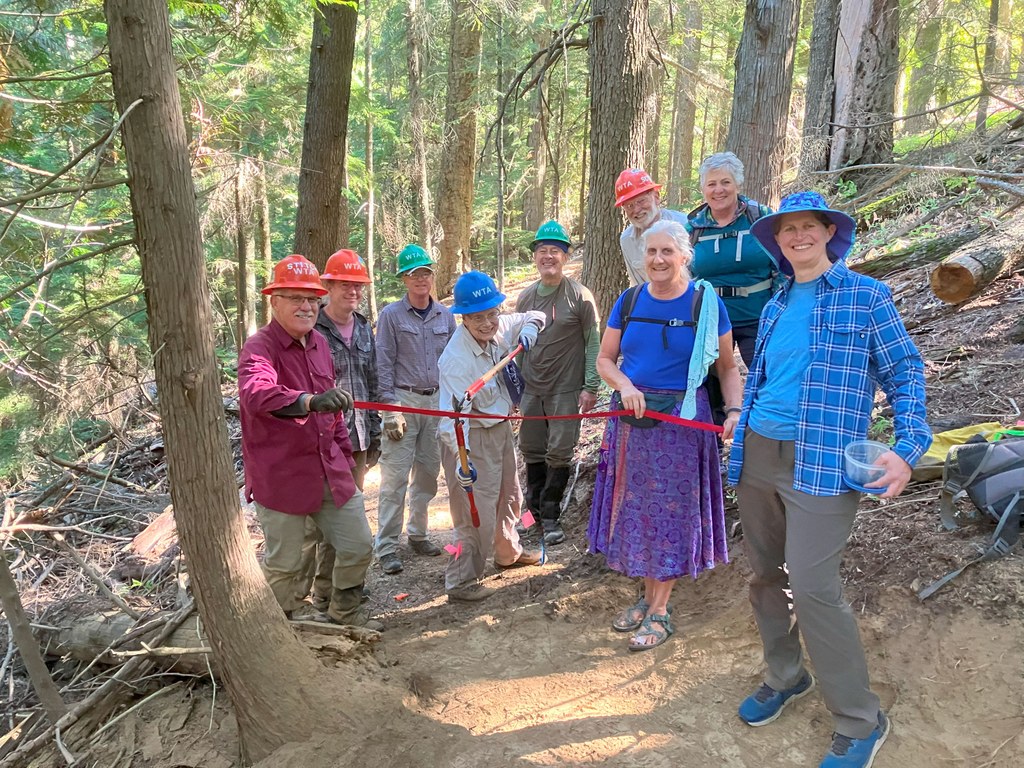
Ribbon cutting on Trail 182. Photo by Rianna Bidon. Full-size image
  • Dogs allowed on leash
  • Fall foliage
  • Good for kids
  • Old growth
  • Wildflowers/Meadows
  • Wildlife

Parking Pass/Entry Fee

Discover Pass, Sno-Parks Permit
Saved to My Backpack

Mount Spokane State Park’s Trail 182 offers park visitors a new beautifully forested singletrack trail option on the western side of the park. The main access point for Trail 182 is via Day Mountain Road, located near Greenbluff, making this the perfect trail to enjoy before visiting the nearby farms and breweries. Continue reading

Rating
0.00 out of 5

(0 votes) Log in to rate

Hiking Mount Spokane State Park - Trail 182

Day Mount Spokane Road reaches its eastern terminus at a Mount Spokane State Park gate, with a wide area for parking along the right side of the road (please, do not block the gate). Day Mountain Road was originally the main vehicle access point to the park but was converted to a non-motorized trail beginning at the park boundary several decades ago. 

Begin the hike by passing the gate and walking approximately a quarter mile on the old roadbed until reaching the lower connection point for Trail 182, located on the left side of the road. The trail gently ascends 942 feet over 3.2 miles through a diverse mature forest, from ponderosa and lodgepole pine interspersed with an occasional white pine to large Douglas fir, hemlock, grand fir, western larch, the occasional cottonwood and even cedar. The forest itself is truly the draw on this trail. 

At the top, Trail 182 intersects the Kit Carson Loop Road, giving hikers several options for extending the hike. Turn right to travel downhill on the Kit Carson Loop Road and the trail reaches a junction with Day Mountain Road in 0.5 miles. Turn right on Day Mountain Road and from there, it’s an easy downhill hike on the former automobile route (complete with a historical marker celebrating the 1929 donation of the land to Washington State Parks at the location where Model T owners used to need to stop to fill their radiators at a trailside spring, the only source of year-round running water in this portion of the park). Pairing Trail 182 with the Day Mountain Road creates a loop hike of 6.5 miles. 

Given the Day Mountain Road’s lower elevation compared to other park trailheads, this trail is perfect for both spring and fall access when the higher elevation trails may have snow on the ground. It’s also ideal for summer due to the shade offered by the tree cover all along the route. Winter access may be slightly more difficult since the Day Mount Spokane trailhead is not maintained as a sno-park during the winter season. 

For that reason, the best winter access for Trail 182 (and a year-round alternate access point) is via the “Hairpin Turn” parking lot at the Lower Mount Kit Carson Loop Road TH. Accessing Trail 182 from this trailhead will add approximately 3 miles to the total trip distance, making it a more challenging snowshoe/XC ski route. The advantage is access to park toilets at both the trailhead and at Smith Gap. Additionally, this route will take visitors past the snowshoe warming hut on both the hike out and the hike back, giving the option of a cozy winter shelter for a picnic stop along the way. 

Toilet Information

  • No toilet at trailhead

More information about toilets

WTA worked here in 2024, 2023, 2022 and 2021!

Hike Description Written by
Holly Weiler, WTA Correspondent

Mount Spokane State Park - Trail 182

Map & Directions

Trailhead
Co-ordinates: 47.8962, -117.1849 Open in Google Maps

Before You Go

See weather forecast

Parking Pass/Entry Fee

Discover Pass, Sno-Parks Permit

WTA Pro Tip: Save a copy of our directions before you leave! App-based driving directions aren't always accurate and data connections may be unreliable as you drive to the trailhead.

Getting There

From I-90, take the Argonne Road exit. Travel north on Argonne, which turns into Bruce Road. Proceed northbound on Bruce through the round-about intersection with Highway 206. Turn east on North Day Mount Spokane Road toward Greenbluff.

From the township of Greenbluff, turn east on East Day Mount Spokane Road for 4.9 miles. At the T-intersection with East Big Meadows Road, turn east on North Day Mount Spokane Road and continue 1.9 miles until arriving at a poorly marked 3-way intersection. Choose the middle road to remain on North Day Mount Spokane Road, continuing 0.5 miles to where the road dead-ends at the Day Mountain Trailhead for Mount Spokane State Park.

More Hike Details

Trailhead

Eastern Washington > Spokane Area/Coeur d'Alene

Washington State Parks

You can improve or add to this guidebook entry!

Mount Spokane State Park - Trail 182

4 Trip Reports

Hiked here recently?

Submit a trip report!
 
Trip Reports