Trails for everyone, forever

Home Go Hiking Hiking Guide Mountain Home Ridge

Mountain Home Ridge

Central Cascades > Leavenworth Area
Length
6.6 miles, roundtrip
Elevation Gain
1,111 feet
Highest Point
3,074 feet
Calculated Difficulty About Calculated Difficulty
Moderate
Gorgeous lupine line the trail on Mountain Home Ridge. Photo by PJ Heusted. Full-size image
  • Dogs allowed on leash
  • Mountain views
  • Ridges/passes
  • Summits
  • Wildflowers/Meadows
  • Wildlife

Parking Pass/Entry Fee

None
Saved to My Backpack

Enjoy stunning views of Wedge Mountain, Peshastin, and the foothills on this multi-use trail without venturing far from the heart of Leavenworth. Continue reading

Rating
0.00 out of 5

(0 votes) Log in to rate

Hiking Mountain Home Ridge

You will start by climbing 0.4 miles up the Main Trail from the parking lot along a
decommissioned Forest Service road before coming to the first junction in this network of trails.

At the junction you’ll be greeted with interpretive information and a map of the area — be sure to snap a quick picture if you forgot to save a map before heading out.
As the grade flattens, follow the Main Trail to the right for 0.4 miles before coming to the Canyon Crest-Rat Creek Ridge trail junction where you have the option to turn your hike into a loop. In just under a mile, depending slightly on which alternate you chose, the trails will meet and the climb upwards continues towards Boundary Butte.

After another 0.8 miles, you’ll reach a junction with actively used USFS Road 7300-500. Follow the trail sharply left and begin the final climb to the summit for 1 mile. Here you’ll be greeted with 360 degree views of Leavenworth and the surrounding valley.

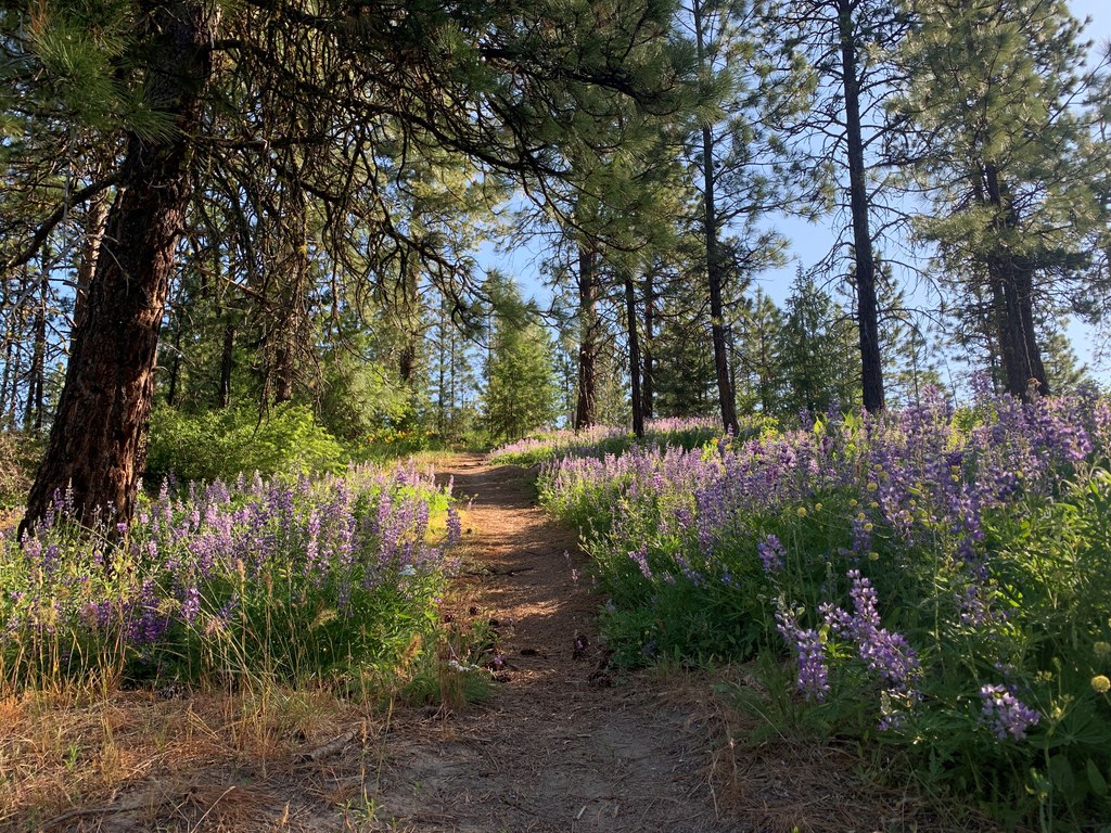
If hiking during the spring, you’ll be rewarded by a full display of wildflowers including arrowleaf balsamroot, several species of lupine, long-leaf phlox, and more! Large ponderosa pines and Douglas fir line the trail, but offer little protection from the sun, especially as you climb up above the ridge and towards the Boundary Butte summit.

WTA Pro Tip: Be sure to apply sunscreen and bring more water than you’d expect as there are no places to refill at the trailhead or on the hike.

Toilet Information

  • Toilet at trailhead

More information about toilets

Mountain Home Ridge

Map & Directions

Before You Go

Parking Pass/Entry Fee

None

WTA Pro Tip: Save a copy of our directions before you leave! App-based driving directions aren't always accurate and data connections may be unreliable as you drive to the trailhead.

Getting There

If you’re driving on Highway 2 east over Steven Pass, turn right onto E Leavenworth Rd/Mountain Home Rd immediately after the bridge over the Wenatchee River.

If you’re driving on US Highway 2 headed west towards Leavenworth from Wenatchee, turn left onto E Leavenworth Rd/Mountain Home Rd after passing the Safeway.

Follow Mountain Home Rd for 3.5 miles until you reach the end of county maintained road and see a large turnout for parking and a privy on the right with a gated road/trail on the left.

There is parking here for approximately 15 cars at the trailhead on dirt and gravel. The road is shared with residential use and suitable for all cars, but be respectful of private landowners on your drive in.

There is a privy, but it is not wheelchair accessible nor is the lot itself.

More Hike Details

Trailhead

Central Cascades > Leavenworth Area

Chelan-Douglas Land Trust and Okanogan-Wenatchee National Forest, Wenatchee River Ranger District

You can improve or add to this guidebook entry!

Mountain Home Ridge

10 Trip Reports

Hiked here recently?

Submit a trip report!
 
Trip Reports