Trails for everyone, forever

Home Go Hiking Hiking Guide Mouth of the Tucannon
link

Mouth of the Tucannon

Eastern Washington > Palouse and Blue Mountains
46.5411, -118.1585 Map & Directions
Length
2.6 miles, roundtrip
Elevation Gain
80 feet
Highest Point
580 feet
Calculated Difficulty About Calculated Difficulty
Easy
  • Wildlife
  • Dogs allowed on leash
  • Rivers

Parking Pass/Entry Fee

None

A low-key stroll to riparian wild-life viewing along the Tucannon River. Continue reading

Rating
2.33 out of 5

(3 votes) Log in to rate

Hiking Mouth of the Tucannon

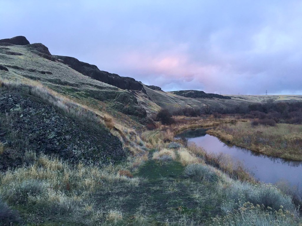
This short hike traverses the 30-acre Tucannon Habitat Management area. The "trail" is a gravel road originally intended to access an old borrow pit near where the Tucannon River flows into the Snake River. The protected riparian area along the river provides a home for an abundance of wildlife in this otherwise dry landscape that will have you wishing for your binoculars if you didn't bring them along.

From the gate, head downstream for 0.2 miles before crossing the first of two cattle barriers. The road meanders close to the river and may be muddy or flooded when run-off is high.

Take your time and look for large raptor nests in the old locust trees and evidence of beaver and porcupine nibbling along the riverbank. Deer tromp through the vegetation and the Tucannon is one of eastern Washington's best trout streams, so be aware that hunters may be present in season. The road ends at an overlook of the delta that makes a nice turnaround spot at 1.3 miles.

Hike Description Written by
Kyle Pomraning, WTA Correspondent

Mouth of the Tucannon

Map & Directions

Trailhead
Co-ordinates: 46.5411, -118.1585 Open in Google Maps

Before You Go

See weather forecast

Parking Pass/Entry Fee

None

WTA Pro Tip: Save a copy of our directions before you leave! App-based driving directions aren't always accurate and data connections may be unreliable as you drive to the trailhead.

Getting There

From Lyons Ferry State Park (the west) head southeast on Highway 261. At 4.3 miles pass the main parking lot for the Tucannon Wildlife Management Area which has a board with a map of the area. Continue another mile on highway 261 to a pullout on the left side of the road just after crossing the Tucannon river on a bridge.

From main street in Starbuck (the east) head northwest on Highway 261 for 2.0 miles to a pullout on the right side of the road just before crossing the Tucannon river on a bridge.

The unmarked pullout has no facilities but a privy is available at the main parking area 1 mile west on highway 261. The hike begins as a gated gravel road with room to park two or three vehicles.

More Hike Details

Trailhead

Eastern Washington > Palouse and Blue Mountains

U.S. Army Corps of Engineers, Walla Walla District

Guidebooks & Maps

Best Desert Hikes: Washington (Bauer & Nelson - Mountaineers Books)

Washington State Department of Natural Resources (DNR) Connell

You can improve or add to this guidebook entry

Mouth of the Tucannon

4 Trip Reports

Hiked here recently?

Submit a trip report!
 
Trip Reports