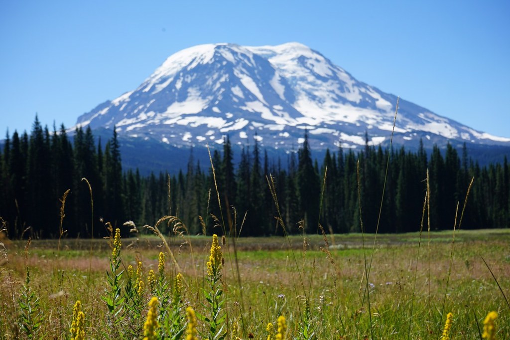

Even before you start your hike, you’ll find fantastic vistas of Mount Adams, as well as elk and deer grazing on sweet grasses at the trailhead. But this is only a foreshadowing of what is to come.
As soon as you set out on trail 13, you’ll duck into sparse conifers as you enter the Mount Adams Wilderness. A wooden bridge traverses some wetlands just 0.3 miles from the trailhead and gives you a few last views into Muddy Meadows before it delivers you back to the Douglas firs and lodgepole pines. Cross another two bridges followed by several gentle switchbacks determined to get you higher into the hills.
At 2.9 miles, arrive at a large trail junction with the Pacific Crest Trail. Cross the PCT and continue on the Muddy Meadows Trail as it slides back into the forest. The signs in this direction point to trail 114 (Highline Trail), which is where you are eventually headed. About 1.3 miles beyond the PCT, the trail crosses over a small meadow and the trees become sparse. Just beyond, to the trail’s left (east), is Muddy Fork Creek and an old camp spot.
A bit further, arrive at a large meadow and a very confusing trail junction. Turn onto the trail 114 that goes to the left (east) rather than the section that goes straight ahead. Follow the gently rolling grade as it alternates between timber and open lands. In 1 mile from the junction with the Highline Trail, arrive at Foggy Flat, a rather large flat meadow with a good view of the north flanks of Mount Adams. A pretty little trailside camp makes a great place to put up a tent and explore the base of Mount Adams.
Muddy Meadows/Foggy Flat

-
 Length
- 11.6 miles, roundtrip
-
 Elevation Gain
- 1,710 feet
-
 Highest Point
- 5,850 feet
This forested trail leads to a fine campsite primed for exploring the base of Mount Adams.
Continue reading
Hiking Muddy Meadows/Foggy Flat

WTA worked here in 2022 and 2021!
Map & Directions
 Trailhead
Before You Go
Parking Pass/Entry Fee
NoneWTA Pro Tip: Save a copy of our directions before you leave! App-based driving directions aren't always accurate and data connections may be unreliable as you drive to the trailhead.
Getting There
From Randle, drive south on Highway 131 and bear left in 0.9 miles to merge onto FR 23. At 18.4 miles from Randle, go left on FR 21. Turn right on FR 5601 (near Adams Fork). Keep left at a small fork on FR 56 (marked Keenes Horse Camp). At 25.9 miles, go right towards an unmarked road (FR 5603 signed Horseshoe Lake). At 31.1 miles turn right on FR 2329 and at 33.2 miles turn left towards Muddy Meadows on FR 085. At 33.3 miles stay left at the road’s fork. Find the trailhead at the road’s end, 33.6 miles from Randle. No pass required.


