Trails for everyone, forever

Home Go Hiking Hiking Guide Old Pass Hill

Alert: On Oct. 1 the federal government began a partial shutdown that will impact National Parks, National Wildlife Refuges and U.S. Forest Service lands in Washington. Here's the latest information we have for hikers and campers


Old Pass Hill

Central Cascades > Blewett Pass
47.3317, -120.6423 Map & Directions
Length
6.5 miles, one-way
Highest Point
4,885 feet

9.22.25: US 97/Blewett Pass is closed between milepost 149-178 (junction with SR 970 and junction with Ingalls Creek Rd south of US 2/97 Don Senn Memorial Interchange) due to the Labor Mountain Fire.

Views are expansive from the summit of Old Pass Hill. Photo by johnwporter.
  • Dogs allowed on leash
  • Mountain views
  • Summits

Parking Pass/Entry Fee

Sno-Parks Permit
Saved to My Backpack

Old Pass Hill is located between Old Blewett Pass and Blewett Pass. The route offers beautiful panoramas of the Teanaway peaks Tronsen Ridge, but even with a decent snow pack, the slide alder that grows on disused logging roads can add difficulty to a trip to the summit. Continue reading

Rating
2.00 out of 5

Hiking Old Pass Hill

Like nearby Cairn Hill, Old Pass Hill's summit is on the exposed east side of the Cascades, so it's best to avoid it on particularly cold days.

It's best to begin from the Blewett Pass Sno-Park and then cross the highway (carefully, of course); that way, your car is off the highway and protected from other traffic. Once across the road, look for the route, which follows Scotty Creek Road (Road 7324). Take this trail, groomed for snowmobiles and hike just under a half mile, where you will join the cross-country ski or snowshoe trail.

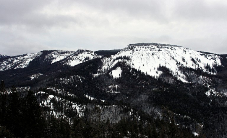
Stay on this road, passing Cairn Hill to the left. After 3 miles, you will reach a saddle on Old Pass Hill. At this point, simply remember to always choose the high roads, which will eventually lead you to the summit. On the way, you'll enjoy views of the surrounding areas, including the Enchantments and, if you're lucky, a peek at Mount Stuart. Blue blazes on the trees alongside the trail should also help you navigate, but do be sure to refer to your map if you are unsure.

Because this route may have unstable snow, travelers should always be fully equipped with avalanche gear and be sure to check the conditions before heading out.

Hike Description Written by
Multiple authors contributed to this report, WTA Community

Old Pass Hill

Map & Directions

Trailhead
Co-ordinates: 47.3317, -120.6423 Open in Google Maps

Before You Go

9.22.25: US 97/Blewett Pass is closed between milepost 149-178 (junction with SR 970 and junction with Ingalls Creek Rd south of US 2/97 Don Senn Memorial Interchange) due to the Labor Mountain Fire.

See weather forecast

Parking Pass/Entry Fee

Sno-Parks Permit

WTA Pro Tip: Save a copy of our directions before you leave! App-based driving directions aren't always accurate and data connections may be unreliable as you drive to the trailhead.

Getting There

From I-90, head east to exit 106, and take Highway 97 north to Wenatchee. Look for the Blewett Pass Sno-Park, marked on the west side of the road.

More Hike Details

Trailhead

Central Cascades > Blewett Pass

Okanogan-Wenatchee National Forest, Cle Elum Ranger District

Guidebooks & Maps

Green Trails Liberty No. 210

You can improve or add to this guidebook entry!

Old Pass Hill

8 Trip Reports

Hiked here recently?

Submit a trip report!
 
Trip Reports