
This trail begins at Crooked Creek Trail 3100 and ends at Smooth Ridge Trail 3105 (Moore Flat). It is maintained for foot and horse traffic since it is located within the Wenaha-Tucannon Wilderness.
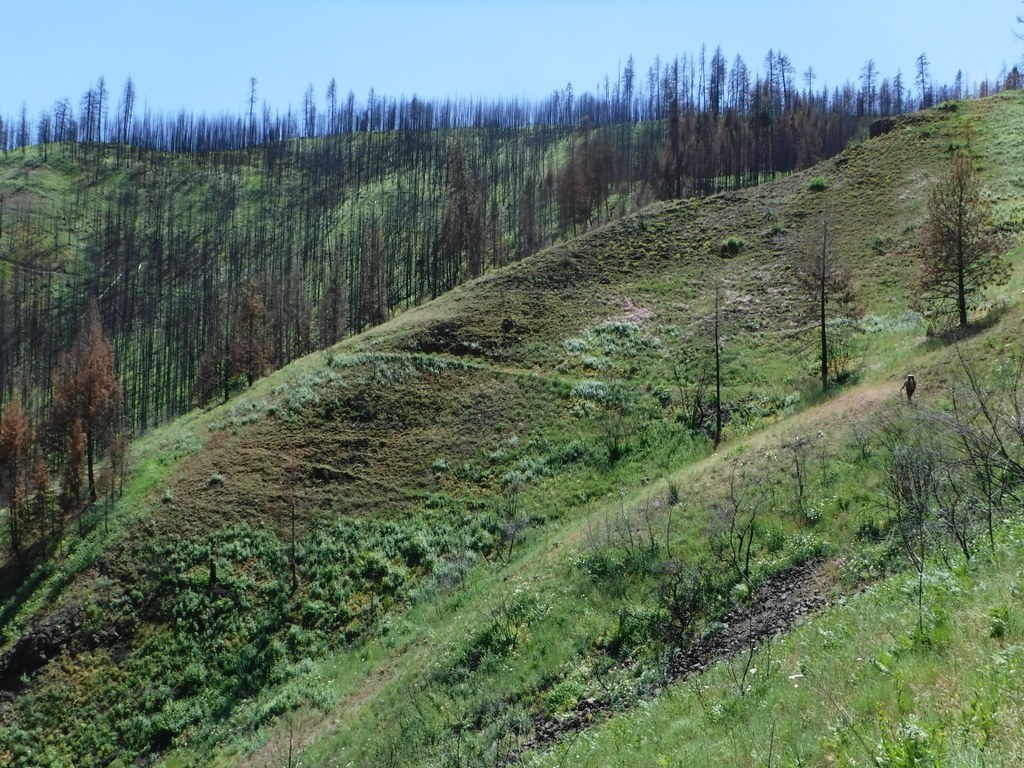
The Packer's Trail offers excellent views of the Crooked Creek drainage from Three Forks to Horse Ridge to Oregon Butte. The view is of rugged country and can be quite breathtaking. There are many places to camp along the ridge top with water available for stock.
From Three Forks Trailhead follow Three Forks Trail 3133 three miles to Crooked Creek. Turn, and head up the creek for a half mile. Take the trail to the left, crossing the creek, and start up Packer's Trail.
The first 3 miles of trail winds gradually with an occasional steep climb to Moore Flat. It is a tough climb up, but the views are fantastic all along the route. Moore Flat was hit very hard by last summer's wildfire. In some areas the understory vegetation is returning, but other areas burned so hot that the soil is still sterile and nothing is growing at all.
There are places along this section where the tread nearly disappears, so carry a good map.
The trail then follows along the ridge the remaining 2.5 miles to where it intersects with Smooth Ridge Trail.
Packer's Trail

-
 Length
- 5.5 miles, one-way
-
 Elevation Gain
- 2,600 feet
-
 Highest Point
- 4,800 feet
Parking Pass/Entry Fee
Northwest Forest Pass
This trail begins at Crooked Creek Trail 3100 and ends at Smooth Ridge Trail 3105 (Moore Flat). It is maintained for foot and horse traffic since it is located within the Wenaha-Tucannon Wilderness.
Continue reading
Hiking Packer's Trail
Map & Directions
 Trailhead
Before You Go
Parking Pass/Entry Fee
Northwest Forest PassWTA Pro Tip: Save a copy of our directions before you leave! App-based driving directions aren't always accurate and data connections may be unreliable as you drive to the trailhead.
Getting There
From Pomeroy, take 15th Street south from State Highway 12. In about 10 miles, the road Ts. Continue straight on to Mountain Road 40. Follow Road 40 for 35 miles. Take first main right coming down off the mountain, Forest Service Road 4039. Follow the road to Three Forks Trailhead. This route is not recommended for vehicles pulling trailers.
From Troy, Oregon, follow signs routing to Pomeroy. Once started up main mountain road, take first left which is Forest Service Road 4039. Follow road around to trailhead.


