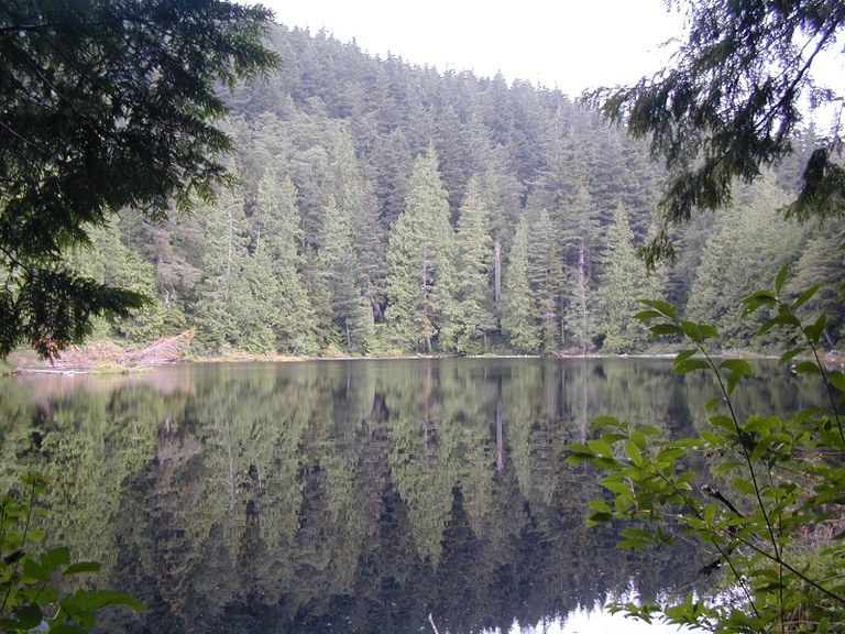

With two small lakes and numerous branching trails that sport views to Mount Baker and the Puget Sound, this moderate trail through shady forest can be hiked or backpacked year round. Trails circle both of these lakes, and on nice days you’ll find people out fishing or canoeing here.
From the trailhead off Old Samish Way, climb a moderate stretch of old dirt road that gradually turns into a trail for 1.6 miles until it levels off at 1,600 feet. Arrive at a signed junction that turns left to Cedar and Pine Lakes or right on the Hemlock Trail, which takes you north, connecting with lots of other trails heading toward Bellingham.
Turn left, heading southeast for 0.3 mile to another junction that turns left (east) to Cedar Lake in 0.2 mile or straight ahead for 0.5 mile to Pine Lake. Trails are well signed throughout the area, so it's difficult to get lost. You may hear traffic from the nearby I-5 for a while, but the noise dissipates when you get behind the hill by the lakes. There are three designated camping areas to choose from but fires are not permitted. Black bears are occasionally sighted here, so practice proper food storage.
The best place to camp is at Pine Lake on the peninsula. You will see a floating boardwalk that will take you left out to the campsite. These boards can sink a little below the surface after a big rain, so you might get your Gore-Tex boots wet. From here there is some good fishing.Some even pack in float tubes.
Once you've set up camp, backtrack to the Hemlock Trail to do some additional exploring. Head over to Raptor Ridge for nice views of the San Juan Islands, or take the newly developed trail that connects with the North Lost Lake Trail (camping not permitted) for a two mile hike. There is also a four mile hike to Fragrance Lake (camping not permitted), or if you are really motivated, head west downhill for six miles to Larrabee State Park to see Wildcat Cove and Chuckanut Bay. All these places in the Chuckanut Mountain Range are definitely worth checking out.
Pine and Cedar Lakes

-
 Length
- 5.0 miles, roundtrip
-
 Elevation Gain
- 1,400 feet
-
 Highest Point
- 1,600 feet
With two small lakes and numerous branching trails that sport views to Mount Baker and the Puget Sound, this moderate trail through shady forest can be hiked or backpacked year round. Trails circle both of these lakes, and on nice days you’ll find people out fishing or canoeing here.
Continue reading
Hiking Pine and Cedar Lakes

WTA worked here in 2021 and 2020!
Map & Directions
 Trailhead
Before You Go
Parking Pass/Entry Fee
NoneWTA Pro Tip: Save a copy of our directions before you leave! App-based driving directions aren't always accurate and data connections may be unreliable as you drive to the trailhead.
Getting There
Follow I-5 south from Bellingham and get off on exit 250. Follow Old Fairhaven Parkway/SR 11 west 0.1 miles to 30th St. Turn left on 30th St and, after about a mile, left onto Old Samish Rd. Drive 1.3 miles to the trailhead parking lot on the right.
If you're coming from the south, take I-5 north to exit 246. Turn right on S Samish way and cross over the freeway, then take the first right onto Old Samish Road. Drive three miles to the trailhead parking sign on the left.


