Trails for everyone, forever

Home Go Hiking Hiking Guide Preston Creek Road Snowshoe

Preston Creek Road Snowshoe

Central Cascades > Entiat Mountains/Lake Chelan
47.8914, -120.4289 Map & Directions
Length
13.8 miles, roundtrip
Views of the Entiat River Valley from the Preston Creek Road. Photo by Darth Thaddeus.
  • Ridges/passes
  • Dogs allowed on leash

Parking Pass/Entry Fee

None
Saved to My Backpack

Preston Creek Road is a relaxing snowshoe along Forest Service Road 5501, accessible directly off Entiat River Road. The path is easy to follow and features several amazing viewpoints. Less than a mile from the trailhead (0.75 miles to be precise), views of the Entait Valley open up, and as you continue up 1.5 miles, Baldy Mountain comes into view. The modest elevation gain is quite gradual, and while you can usually hear the traffic from the Entiat River Road, the noise is minimal. Continue reading

Rating
4.00 out of 5

Hiking Preston Creek Road Snowshoe

Preston Creek Road is a relaxing snowshoe along Forest Service Road 5501, accessible directly off Entiat River Road. The path is easy to follow and features several amazing viewpoints. Less than a mile from the trailhead (0.75 miles to be precise), views of the Entait Valley open up, and as you continue up 1.5 miles, Baldy Mountain comes into view. The modest elevation gain is quite gradual, and while you can usually hear the traffic from the Entiat River Road, the noise is minimal.

The beginning of this route is a steep climb, which can be challenging when it is icy (or if you're fairly new to cross-country skiing or snowshoeing). The first two miles climb nearly 1000 feet to a signed intersection at 2760 feet of elevation. 

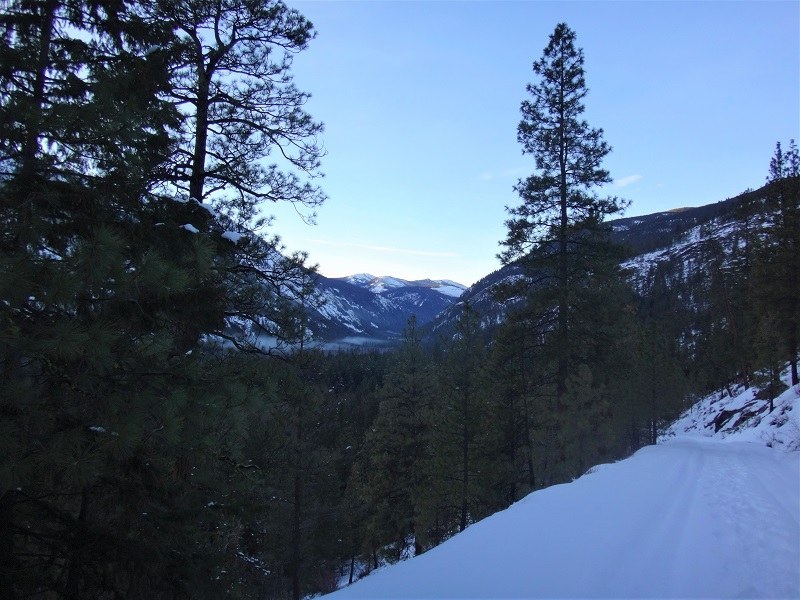
If you take a left here you'll climb (though more moderately than before). A mile in, you'll enjoy views over the Entiat Valley. Continue on as long as you like; this road rolls on for miles. 

If you decide to go straight ahead at the intersection, you will follow the road for a mile as it traverses above Preston Creek, crosses the same creek and arrives at another intersection. At this intersection, you can head either right or left.

Taking the right trail will deliver you to a saddle after 2.5 miles, and further exploration down the road. But, if you choose to go left, you'll arrive at a saddle in 2.5 miles with good views. While these views are nice, if you've got the energy, continue a further 1.4 miles to the end of the road. On a clear day, you'll be rewarded by even more of those spectacular views for almost the entire last section of road. 

Note: The data for this entry reflect the route that delivers you to the high ridgeline with the 1.4-mile walk to the end of the road. From the trailhead, hike to the first intersection and continue straight through it. At the second intersection, take the right trail. 

Hike Description Written by
Multiple authors contributed to this report, WTA Community

Preston Creek Road Snowshoe

Map & Directions

Trailhead
Co-ordinates: 47.8914, -120.4289 Open in Google Maps

Before You Go

See weather forecast

Parking Pass/Entry Fee

None

WTA Pro Tip: Save a copy of our directions before you leave! App-based driving directions aren't always accurate and data connections may be unreliable as you drive to the trailhead.

Getting There

Turn north on the Entiat River Road from Highway 97-A. Proceed about three-quarters of a mile beyond Brief (a tiny hamlet past Enitat) and park on the right side of the road at milepost 22.5.

The county plows a small parking area at the base of the Preston Creek Road (Forest Road 5501).

More Hike Details

Trailhead

Central Cascades > Entiat Mountains/Lake Chelan

Okanogan-Wenatchee National Forest, Entiat Ranger District

You can improve or add to this guidebook entry!

Preston Creek Road Snowshoe

1 Trip Report

Hiked here recently?

Submit a trip report!
 
Trip Reports