
Nestled in the far, far southeast corner of Washington State, Puffer Butte is a year-round favorite, and the jewel of the Fields Spring State Park — a beautiful part of the state park system here.
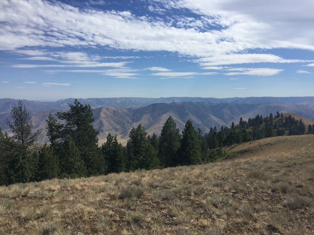
Puffer Butte is the high point in Fields Spring State Park, where you can see incredible vistas of the Wallowa Mountains. Dusted with snow in the winter or dotted with flowers in summer, you'll take in these views with very little sweat expended.
Starting from the parking lot, look for a somewhat brushy trail signed for Puffer Butte. Set out on this trail, which intersects several other old roads and trails. Stick to it though — grand views await you at the end of your upward trek. And, after all, it's only a mile long.
In summer, the views and flattish summit are a nice relaxing way to spend a couple of hours. But if you're snowshoeing (or just visiting in the chilly season), a warming hut on the edge of the forest near the summit offers a spectacular view south, down toward the canyon of the Grande Ronde. Behind it, the Wallowas in Oregon roll away, like folds in the earth. Dusted with snow, they complete a breathtaking vista.
For the return trip, head south from the hut and turn left at the sign for "Puffer Butte Lodge." The trail is narrow and steep but provides beautiful views of the hills and valleys to the southeast. When you reach the lodge you have a choice of roads and trails to return to the trailhead.
Field Springs State Park - Puffer Butte

-
 Length
- 2.1 miles, roundtrip
-
 Elevation Gain
- 500 feet
-
 Highest Point
- 4,500 feet
Nestled in the far, far southeast corner of Washington State, Puffer Butte is a year-round favorite, and the jewel of the Fields Spring State Park — a beautiful part of the state park system here.
Continue reading
Hiking Field Springs State Park - Puffer Butte
Map & Directions
 Trailhead
Before You Go
Parking Pass/Entry Fee
Discover Pass, Sno-Parks PermitWTA Pro Tip: Save a copy of our directions before you leave! App-based driving directions aren't always accurate and data connections may be unreliable as you drive to the trailhead.
Getting There
From Clarkston, head southwest on Diagonal St toward 6th St. Turn left onto WA-129 S/6th St and stay on this road for 5.9 miles. Turn right onto WA-129 S/Washington St and stay here for 22.9 miles. Veer left off the main road onto Park Road, and continue for a half mile. Turn right to enter the park proper. Turn left at the bulletin board to enter the parking lot or stay straight to go to the park office.


