

The Ravensdale Retreat Natural Area is a 145-acre park in historic Ravensdale, south of the Issaquah Alps. The natural area borders Rock Creek to the south, below Ravensdale Ridge. It's primarily intended for foot traffic, but you may see an occasional equestrian rider. Mountain bikes are discouraged but not disallowed; the nearby Black Diamond Natural Area has trails that are specifically designed with proper tread and pitch on turns for bikes. While there are several trails across the natural area, this entry describes a lollipop loop to catch the highlights.
Park at Ravensdale Park to the west of Ravensdale Way near the Ravensdale Park Community Meadow. Be careful crossing Ravensdale Way to the trailhead, which is less than 100 feet north. Enter Ravensdale Retreat Natural Area at the King County Parks sign onto the main west-side route, Gracie Trail. This trail is named for the legendary Seattle entertainer, Gracie Hansen, whose Paradise International building was relocated to Ravensdale in the 1960's and repurposed as a community center.
The west side of the natural area is primarily second-growth Douglas-fir trees, contrasted by a sea of sword ferns covering the ground. You'll also see Oregon grape and foxglove along the trail.
After about 0.7 miles, a small stream crosses the trail. The rocky stream bed is generally easy to step across, although it can get a few inches deep after periods of heavy rain.
You'll come to an area cleared of trees 0.25 miles later. The trail continues ahead, bear left. This cleared area, and others like it you'll see throughout the natural area, is due to planned work by King County Parks to selectively thin the forest for its overall health. The county has started to replant in areas, and plans to continue replanting in 2021.
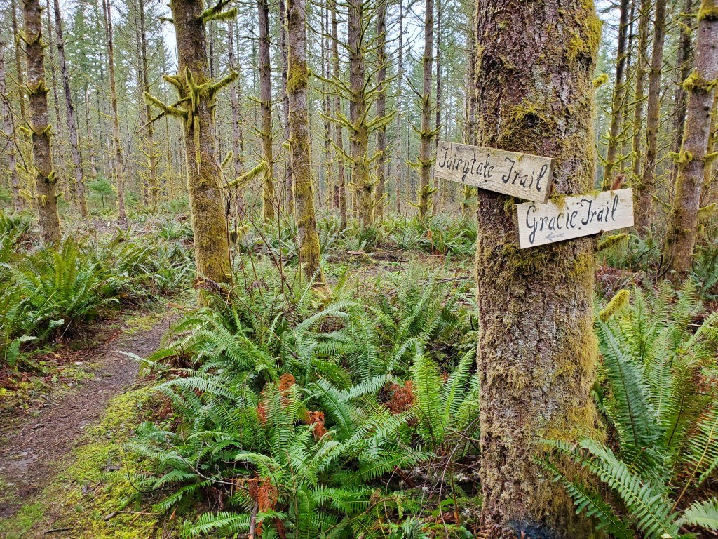
About 300 feet later (one mile from the parking lot) is the first intersection. You'll see signs for the Gracie Trail and the Fairytale Trail. These signs were created and placed by a local Girl Scout troop, in partnership with King County Parks. Turn left onto Fairytale Trail, where the forest density increases with some more variety of tree species.
After 0.1 miles you come to another intersection, this one without any signs. Turn left to head north. Another 0.1 miles and you reach the gravel access road that cuts through the natural area. Turn left on the road, then turn right onto a wide trail that heads up hill to the east. This wide trail climbs 40 feet up 0.1 miles to a wide clearing.
Through the clearing, the trail narrows and reenters the forest to the right, where it soon descends to an intersection. Take a left, and go up the hill to a four-way intersection amongst a grove of red alder trees. Continue straight ahead, where the trail heads south along a small ridge. You'll see a small pond below to your right, which isn't accessible, but you may start to hear frogs. Just past the pond is a fork in the trail. Continue to the left, up the hill.
You'll come to the steepest part of this hike, a 70-foot ascent over 0.1 miles up the ridge. At the top is an intersection, which is near the southeast corner of the natural area. Turn right and continue up hill a couple of hundred feet to a clearing. You'll start to see signs for "Liam's Trail" with some words of encouragement, like "When the path reveals itself, follow it."
Keep in the same direction through the clearing, where the trail widens and descends. Keep an eye out for other Liam's Trail signs! At the bottom of the hill you'll see a trail fork off to the right back towards the pond. Continue straight on the wide Liam's Trail, which soon intersects with the gravel road. Just before the road is a small swale, which may have runoff from the nearby Rock Creek. Except during times of extremely heavy rain, there are enough large rocks to step across the swale to the gravel road. Turn right and head north up the gravel road.
This section of the road shows the remarkable difference between the two sides of the natural area. The west side is primarily Douglas-fir, while the east side is much more diverse with maples, cedars, cottonwoods, western hemlock, and red alder. Walk about 600 feet along the road until you see a trail cut west into the forest on the left.
You're back on the Gracie Trail, and after crossing a cleared swath, return to the intersection of the Gracie and Fairytale trails. Turn left and head west one mile along the Gracie Trail back to the parking lot.
Before or after your hike through the natural area, visit the sign board at the community meadow, which introduces the history trail. There are 15 total signs around Ravensdale Park on a 0.75-mile route that explores the history of the area. Much of it was dominated by coal mining, which led to the early growth and eventual downfall of the original company town. No spoilers here, you'll have to visit the signs to get the full story!
Before you leave the area, stop in at the Ravensdale Market for sundries and supplies, and to say hi to Elliot the Elk.

 Trailhead


