
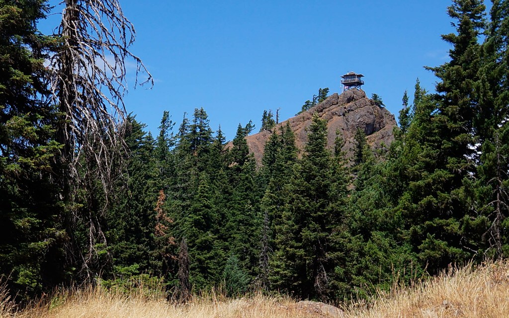

Start your hike from the parking lot, continuing up the dirt road. Spot Red Top Lookout perched on Teanaway Ridge above you, and continue up the path and over a dirt mound to the trail ahead. Enter a shaded forest and come upon a sign for the Teanaway Ridge Trail. Turn left here and start your 0.5-mile climb to the lookout.
The trail is steep, but short and easy to follow. Catch your breath by admiring the variety of wildflowers lining the trail, such as the tiny white flowers of the common yarrow and the pretty purple petals of the aster. Look up to Mount Rainier as it slowly peeks out from the southwest.
Breaking out of the forest, you soon reach an exposed, rocky ridge and Red Top Lookout. The Stuart Range and Teanaway Ridge spread before you to the north, the Chelan and Entiat Mountains to the northeast, and South Cle Elum, Mount Adams and Mount Rainier to the southwest. Spot a large solar panel to the immediate north of the lookout. The panel powers a radio repeater that transmits radio signals over the rugged terrain.
If the lookout is open, take the time to examine the many resources inside. Take a look at the panoramic map nailed on one of the walls and see how many peaks you can identify. Check out the large, compass-like device in the center of the lookout called an Osbourne Firefinder. This tool helps lookout volunteers pinpoint the location of a distant fire, which they can then relay to the Central Washington Interagency Communication Center.
You can walk a bit beyond the lookout on a short ridge about 50 feet long for further views. This section, and the area surrounding the lookout, is surrounded by steep drop-offs and rocks that are easy to slip on; exercise caution with children and those who might need a helping hand.
Extend your hike
Make it a loop! Instead of descending back the way you came, hike north from the lookout towards the big rock at the end of the ridge. Bear right at a fork in the trail and continue down the switchbacks. The trail continues to descend steeply, and in about 0.2 mile, arrive at a junction with a sign marked Teanaway Ridge Trail 1364 nailed to a tree. Turn right to head back to the parking lot. The trail here is gently rolling with a couple of narrow, rocky sections and steep drop-offs, so exercise caution. This route is slightly longer than the 0.5-mile route, clocking in at about 0.65 mile, meaning the loop is about 1.05 miles total.
WTA Pro Tip: Red Top Lookout and the trail to it is a popular place to find agates and thunder eggs. Starting at the trailhead, continue up the dirt road for about 0.2 mile until you reach the Teanaway Ridge Trail sign. Turn right at the sign to reach the agate beds in one mile.
There is a guide posted near the agate beds with helpful hints about the rock beds. As with wildflowers or anything else on trail, please refrain from taking these home in order to let future hikers discover these remarkable rocks as well.
 Trailhead


