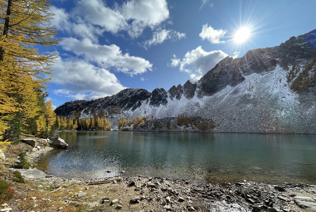

This is a classic backpack ideal in larch season. The loop can be done at a comfortable pace in three days, or you can allow more time to explore this part of the Sawtooth Wilderness with side trips from your camps.
Start at the Crater Creek trailhead heading for Boiling Lake. From the trailhead at 4,700 feet, take trail 431 past the Crater Lake trail and past the Martin Creek trail at 2.0 miles and continue on.
At 5.8 miles, you can go right to upper Eagle Lake or shortly after that, left to Eagle (7 miles from the trailhead). Neither of these are well signed but you will notice that you pass through some established campsites. There is a broken wooden sign on a tree directing you 1.0 mile straight on to Horsehead Pass (7.7 miles) then you drop down to Boiling Lake (8.7 miles from the trailhead). There are several established camp sites and a toilet at the lake.
To continue to Cooney Lake (7.5 miles from Boiling Lake)head west, following a sign for Cub Lake. In 1.0 mile you will reach the Summit Trail where you turn left. (There is a smaller, unmarked trail to the left just before the Summit Trail junction which you should ignore as it leads back to Boiling Lake). The Summit Trail heads south through lovely meadows. After 2.5 miles, head left on a trail marked Angels Staircase. Be forewarned this is a narrow, steep, shelf trail 2.6 miles up to the top, but the views are fantastic. At the top, follow the trail as it heads north across a rocky slope for about half a mile. You will come to an unmarked trail junction. Turn left up to a small saddle. From there you will see Cooney Lake below and take a steep, difficult but short trail down to reach the lake. Note that steep snow can make for a treacherous descent before July -- be prepared to negotiate this. Most campsites and a toilet are at the north end of the lake.
To continue from Cooney Lake to Crater Creek trailhead (8.2 miles), head north from the lake a few hundred yards where you will intersect with the Martin Lake Trail. Turn left (north). At 2.2 miles from Cooney Lake you will pass a trail to the left leading to Martin Lake. But to reach the Crater Creek trailhead, continue straight another 4 miles on 429 to trail 431. Go right on 431 and hike the final 2 miles to the trailhead.
Sawtooth Lakes Loop

-
 Length
- 24.0 miles, roundtrip
-
 Elevation Gain
- 5,200 feet
-
 Highest Point
- 8,000 feet
Parking Pass/Entry Fee
Northwest Forest Pass
This is a classic multi-day backpack ideal in larch season.
Continue reading
Hiking Sawtooth Lakes Loop
Map & Directions
 Trailhead
Before You Go
Parking Pass/Entry Fee
Northwest Forest PassWTA Pro Tip: Save a copy of our directions before you leave! App-based driving directions aren't always accurate and data connections may be unreliable as you drive to the trailhead.
Getting There
From Pateros on the Columbia River, drive 17 miles north on Hwy 153. From 153, turn left on the county road signed “Gold Creek Loop” and go 1.5 miles. Turn left on road No. 4340, following signs for Foggy Dew Campground. (You can also approach from the north if you drive 18 miles south from Twisp, turn right on Gold Creek Loop road and right on road 4340). Drive 6.0 miles on 4340 where you will pass Foggy Dew Campground. To reach the Crater Creek trailhead, continue straight 0.7 miles and fork to the left on 4340 at a junction that is marked as road 300. Continue 4.6 miles to the trailhead.


