Trails for everyone, forever

Home Go Hiking Hiking Guide Schriebers Meadow Snowshoe

Schriebers Meadow Snowshoe

North Cascades > Mount Baker Area
48.6819, -121.7597 Map & Directions
Length
11.0 miles, roundtrip
Elevation Gain
1,200 feet
Highest Point
5,200 feet
Calculated Difficulty About Calculated Difficulty
Moderate/Hard
Schriebers Meadow Snowshoe, photo by ngie. Full-size image
  • Mountain views
  • Established campsites

Parking Pass/Entry Fee

Sno-Parks Permit

On the flanks of Mount Baker’s south side, Schriebers Meadow makes for a delightful snowshoe excursion, either for a daytrip or an overnight experience. Continue reading

Rating
4.33 out of 5

(3 votes) Log in to rate

Hiking Schriebers Meadow Snowshoe

Schriebers Meadow is a popular hiking destination in the summer and fall, but it becomes a true winter wonderland in the snowy months. With magnificent Mount Baker towering above the rolling snowfields of the alpine meadows, there is plenty of room to roam and take in the scenery. However, be prepared to share the trail with both snowmobilers and cross-country skiers. Practice good trail etiquette by staying out of ski tracks and listening for approaching snowmobiles so you can stay safely out of the way.

From the Sno-Park, make your way up snow-covered Forest Road 13. For five miles climb gently under a canopy of trees as the wide roadway makes its way along a hillside above Sulphur Creek. Eventually the road ends at the summer trailhead for the Mount Baker National Recreation Area. 

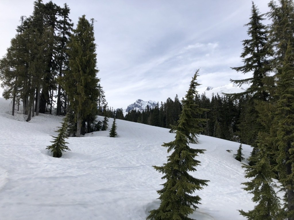
From the expansive summer parking area, the trail narrows as it crosses Sulphur Creek and reaches the edge of Schriebers Meadow. From here, feel free to explore to your heart’s content, finding a space away from the crowds to enjoy lunch or set up camp.

If you have enough energy left and are confident in your navigation and snow travel skills, consider pushing onward toward Survey Point, which offers views of not only Mount Baker, but also Park and Black buttes and Schriebers Meadow below. This point lies northwest of Schriebers Meadow and should only be attempted if you have the experience and skills to select a safe route and know how to read avalanche terrain and conditions. Otherwise continue to enjoy the meadow before heading back.

WTA worked here in 2017!

Hike Description Written by
Lindsay Leffelman, WTA Correspondent

Schriebers Meadow Snowshoe

Map & Directions

Trailhead
Co-ordinates: 48.6819, -121.7597 Open in Google Maps

Before You Go

See weather forecast

Parking Pass/Entry Fee

Sno-Parks Permit

WTA Pro Tip: Save a copy of our directions before you leave! App-based driving directions aren't always accurate and data connections may be unreliable as you drive to the trailhead.

Getting There

From Sedro-Woolley, drive east on State Route 20 for 14 miles. Turn north on Baker Lake Road (Forest Road 11). Continue for 12.5 miles, then turn left on Forest Road 12. Continue for 3.5 miles to the Sno-Park located at the junction with Forest Road 13.

More Hike Details

Trailhead

North Cascades > Mount Baker Area

Mt. Baker-Snoqualmie National Forest, Mount Baker Ranger District

Guidebooks & Maps

Green Trails: Hamilton No. 45

Lake Shannon No. 46

You can improve or add to this guidebook entry

Schriebers Meadow Snowshoe

14 Trip Reports

Hiked here recently?

Submit a trip report!
 
Trip Reports