
The views from the top of 7,009 foot Scotchman Peak are gorgeous enough to allow visitors to forget that they gained 3,730 feet in elevation over the course of 3.5 miles to get there. With more than 1,000 feet gained per mile, it is one tough training hike, but it is well-worth the effort it takes to get to the top.
Long-proposed for protection as part of the Scotchman Peak Wilderness, this is a very wild area that's still easily accessible. The trail is undergoing improvements to its too-steep grade, so the round trip mileage will eventually be a bit longer. There's nothing to be done about the elevation gain, which is actually more in the winter when the TH is inaccessible and intrepid snowshoers and backcountry skiers must start a little lower down and closer to town. Check avy conditions before a winter visit.
The beginning of the hike is in a recovering forest with few views, so watch for the local flora and fauna instead. Spring wildflowers eventually give way to summer huckleberries along the route. Approximately two-thirds of the way up, the trail leaves the trees and enters a rocky section. The views are impressive, with Lake Pend Oreille shimmering far below and other peaks all around.
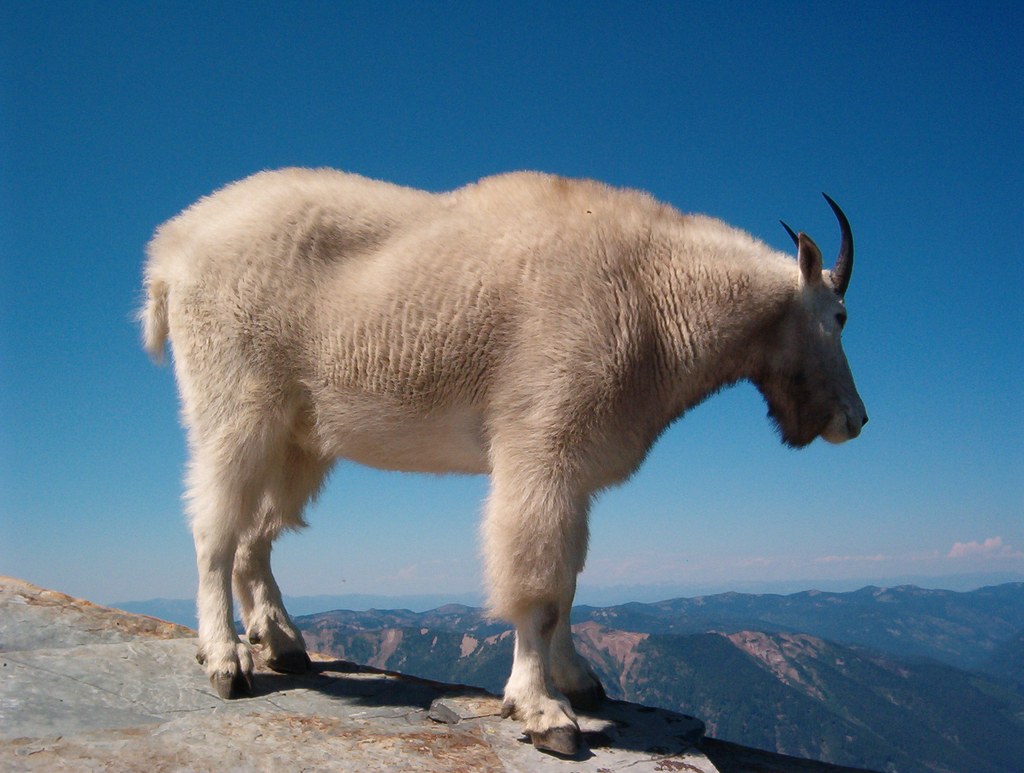
At the summit, site of an old fire lookout, keep an eye out for Mr. Scotchman (actually any number of local mountain goats). Please don't feed or approach the goats! The trail was closed for a time in the summer of 2015 due to habituated goats. Keep dogs on leash and keep all food stowed safely in your pack. Keep your pack on or nearby as well, as the goats will attempt to lick salt off the straps of unattended packs.
Scotchman Peak

-
 Length
- 7.0 miles, roundtrip
-
 Elevation Gain
- 3,730 feet
-
 Highest Point
- 7,009 feet
Parking Pass/Entry Fee
None
Located above Clark Fork, Idaho, visitors earn the fantastic views of Lake Pend Oreille by gaining nearly 3,730 feet of elevation in a seven mile roundtrip hike.
Continue reading
Hiking Scotchman Peak
Map & Directions
 Trailhead
Before You Go
Parking Pass/Entry Fee
NoneWTA Pro Tip: Save a copy of our directions before you leave! App-based driving directions aren't always accurate and data connections may be unreliable as you drive to the trailhead.
Getting There
From Sandpoint, ID, take SR 200 east to Clark Fork, Idaho. Turn north on Main Street in downtown Clark Fork, entrance to the National Forest. Main street becomes Forest Road 276 (Mosquito Creek). After about 2.5 miles, turn right on Forest Road 2295 and continue about 1 mile. Turn left on road 2294 and watch for signs for Trail 65 (Scotchman Peak) in about 1 mile. The road ends at the trailhead.


