
Sheep Lake is a picturesque alpine lake guarded by jagged-edged ridges. It makes a good destination for children, especially if you let them swim, play in the meadows, or explore the small rock outcroppings. Sheep Lake is also a worthy destination for adults who want a pause from daily life to enjoy the outdoors. The campsites around the perimeter are ideal for base camping or for backpacking with children.
The hike to Sheep Lake is a 1.8 mile gentle climb on a good trail. The first mile traverses a steep slope above Highway 410. The hillside is decorated with wildflowers in the summer and red huckleberry plants in the fall. Although the trail dips in and out pockets of trees, the views are quite good. You can get a bird’s eye view of the deep valley of the Rainier fork of the American River. You will also be treated to glimpses of Mt. Rainier and Naches Peak.
After the traverse, the trail turns north leaving the highway and the road sounds behind. The trail enters a forested area interspersed with small meadows. The trail eventually enters an alpine setting and climbs a bit more to Sheep Lake.
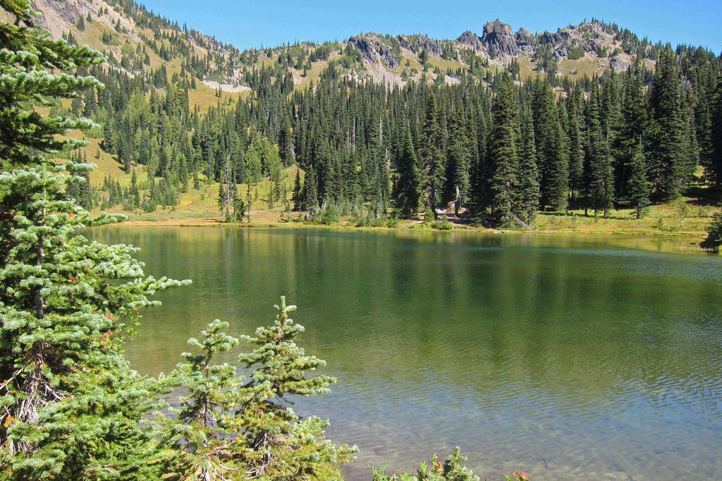
Sheep Lake is a green gem that pops into view as you near it. You may hear the happy sounds of children playing in the water or see hikers lazing on the rock outcropping where the trail comes to the lake. This outcropping is the perfect place to take a break, while the nearby beach may tempt you to take off your boots and wade in the crystalline water.
After enjoying the lake, retrace your steps to return to your car.
WTA Pro Tip: If you are planning to backpack, finding a campsite should be your first priority. This is a very popular destination, and the campsites fill early. Start early, and when you arrive, pitch your tent and then enjoy the lake.
Sheep Lake

-
 Length
- 3.6 miles, roundtrip
-
 Elevation Gain
- 400 feet
-
 Highest Point
- 5,750 feet
SR 410 (Chinook Pass) is closed between Crystal Mountain Boulevard (12 mi north of summit) and Morse Creek (5 mi east of summit) for the winter season.
Sheep Lake is a picturesque alpine lake guarded by jagged-edged ridges. It makes a good destination for children, especially if you let them swim, play in the meadows, or explore the small rock outcroppings. Sheep Lake is also a worthy destination for adults who want a pause from daily life to enjoy the outdoors. The campsites around the perimeter are ideal for base camping or for backpacking with children.
Continue reading
Hiking Sheep Lake
Map & Directions
 Trailhead
Before You Go
SR 410 (Chinook Pass) is closed between Crystal Mountain Boulevard (12 mi north of summit) and Morse Creek (5 mi east of summit) for the winter season.
Parking Pass/Entry Fee
Northwest Forest PassWTA Pro Tip: Save a copy of our directions before you leave! App-based driving directions aren't always accurate and data connections may be unreliable as you drive to the trailhead.
Getting There
From Enumclaw, drive east on SR 410 for about 50 miles to Chinook Pass. Continue about 0.2 miles to Pacific Crest Trail parking lot, which is the second large parking lot on the left side of the road. The trailhead is on the east end of the parking lot behind the vault toilets.
From Naches, drive west on Highway 12 to the junction with SR 410. Turn onto SR 410, and drive about 45 miles to the Pacific Crest Trail parking lot, on the right side of the road about 0.2 miles from the top of the pass. If you get to the Tipsoo Lake parking lot, you have gone too far. The trailhead is on the east end of the parking lot behind the vault toilets.
From Packwood, drive east on Highway 12 to the junction with State Highway 123. Go north on State Highway 123 about 16 miles to the junction with SR 410. Turn right onto SR 410. Continue about 0.2 miles to Pacific Crest Trail trailhead parking lot, which is the second large parking lot on the left side of the road. The trailhead is on the east end of the parking lot behind the vault toilets.


