
The trail starts off on Sand Ridge Trail, which follows a dirt road for a short distance before narrowing into an actual trail. The trail is dusty and popular with the horsey crowd, so watch your step.
At 0.7 mile after several switchbacks, pass an easy-to-miss junction with Little Buck Trail, coming in from the right (north). Stay on the Sand Ridge Trail, climbing more than 1000 feet in less than 2 miles. In 2.8 miles from the trailhead, switch trails at a junction with Shellrock Lake trail, which stays straight and takes you into a thicker forest landscape.
In just over 2 miles from where you hopped on Shellrock Lake Trail, the trail levels off, crosses under a talus field and passes a large swampy pond to the right. Look for wood ducks and mergansers as you walk quietly in this peaceful area.
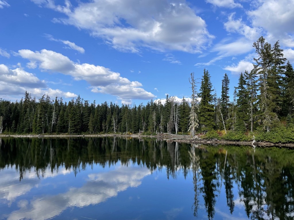
The trail crosses a coniferous grove before popping you at your destination, the scenic shores of Shellrock Lake. To the north, the tippy-top of Tumac Mountain is visible. A couple shoreline campsite invite you to take-a-load-off and enjoy this park like setting before heading back.
WTA Pro Tip: In summer, you might want to make a scenic drive out of the day by following Highway 12 east to Highway 410, then turning west and returning over Chinook Pass.
Shellrock Lake

-
 Length
- 10.0 miles, roundtrip
-
 Elevation Gain
- 1,900 feet
-
 Highest Point
- 5,930 feet
Like so many lakes in the William O Douglas Wilderness, Shellrock Lake has peaceful solitude and plentiful wildlife including resident elk which graze in the meadows nearby.
Continue reading
Hiking Shellrock Lake
Shellrock Lake
Map & Directions
 Trailhead
Before You Go
Parking Pass/Entry Fee
Northwest Forest PassWTA Pro Tip: Save a copy of our directions before you leave! App-based driving directions aren't always accurate and data connections may be unreliable as you drive to the trailhead.


