

This trail ascends the south slopes of Mount Adams through dry lodgepole pine forest and crosses Shorthorn Creek and Crofton Creek before ending at the Round the Mountain Trail at treeline.
This former livestock route gave the trail its name (Shorthorn, as in cattle) more than a century ago. Ranchers brought their animals to graze the southern slopes of Mount Adams in the 1890s. Grazing by cattle and sheep caused significant damage to meadows and streams in the alpine and subalpine areas. The Columbia National Forest was established in 1908 and grazing allotments were designated, which put in controls on livestock. Many decades passed before livestock were banned from the mountain’s meadows.
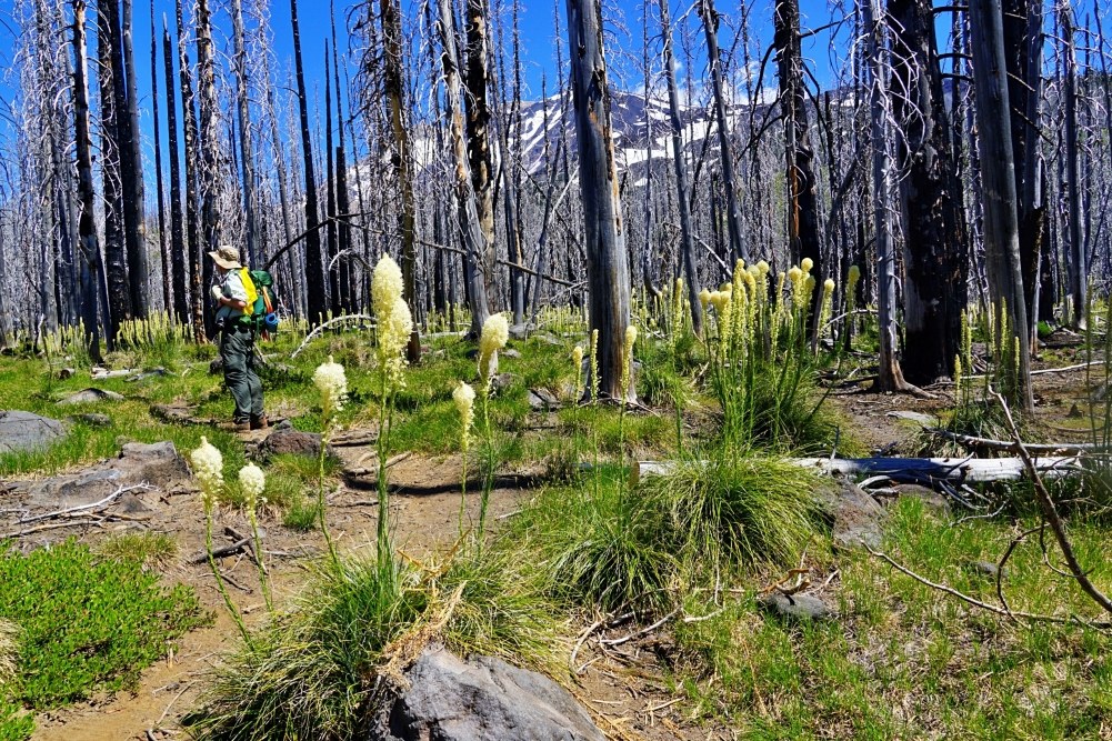
The entire Shorthorn Trail traverses burned forest from the Cascade Creek Fire, which was started by lightning in 2012. The blackened trees form a backdrop for all the wildflowers that cover the now-sunny ground.
This trail doesn’t go to any lake, waterfall or viewpoint, and meets the Round-the-Mountain Trail at an unimposing junction, but enjoy this hike for the wildflowers, particularly the extensive acres of beargrass. The view of Mount Adams through the forest is getting better every year as more burned snags fall. Along the way, the trail passes through brilliant blooms of beargrass and phlox. Crofton Creek carves a deep ravine as it descends from the high glaciers on Mount Adams.
At 1.8 miles in, pause at the green, flower-filled oasis at the Shorthorn Creek crossing, where the narrow riparian zone escaped the fire. Continue on to cross Crofton Creek in its deep gully at 2.3 miles, then climb steeply up switchbacks to trail’s end at the junction with the Round-the-Mountain Trail #9 in 2.8 miles.
WTA Pro Tip: Stop at the Trout Lake Station Espresso for a post-hike huckleberry smoothie. Huckleberry pie and milkshakes are available on the other side of the building at the Trout Lake Station Cafe.

 Trailhead


