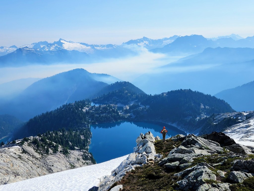

Snowking Mountain is a strenuous mountaineering trip or class 3 alpine scramble with stunning panoramic mountain views, deep blue alpine lakes and rewarding isolation.
Snowking Mountain

-
 Highest Point
- 7,433 feet
Parking Pass/Entry Fee
National Park Pass, Northwest Forest PassPermits Required
Wilderness permit. Self-issue at trailhead (no fee)
Snowking Mountain is a strenuous mountaineering trip or class 3 alpine scramble with stunning panoramic mountain views, deep blue alpine lakes and rewarding isolation.
Continue reading
Hiking Snowking Mountain
Snowking Mountain
Map & Directions
 Trailhead
Before You Go
Parking Pass/Entry Fee
National Park Pass, Northwest Forest PassPermits Required
Wilderness permit. Self-issue at trailhead (no fee)WTA Pro Tip: Save a copy of our directions before you leave! App-based driving directions aren't always accurate and data connections may be unreliable as you drive to the trailhead.


