Trails for everyone, forever

Home Go Hiking Hiking Guide Leque Island - Stanwood Levee Trail
link

Leque Island - Stanwood Levee Trail

Puget Sound and Islands > Seattle-Tacoma Area
48.2309, -122.3823 Map & Directions
Length
1.4 miles, roundtrip
Elevation Gain
0 feet
Highest Point
15 feet
Calculated Difficulty About Calculated Difficulty
Easy
Gorgeous mountain vistas and lots of wildlife await you at Stanwood Levee. Photo by Dennis Graver.
  • Mountain views
  • Wildlife
  • Coast
  • Good for kids
  • Rivers

Hike a trail on top of an elevated berm that leads into a newly restored tidal marsh on Leque Island. Enjoy sights and sounds of hawks, ducks, and other birds, in addition to breathtaking views of the Olympics and North Cascades. Continue reading

Rating
4.75 out of 5

(4 votes) Log in to rate

Hiking Leque Island - Stanwood Levee Trail

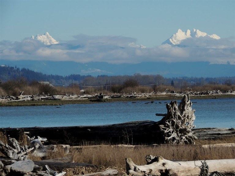
Hike on top of a berm that leads into a newly restored tidal marsh on Leque Island, located between Camano Island and the City of Stanwood. Enjoy sights and sounds of hawks, ducks, and other birds, in addition to breathtaking views of the North Cascades and Olympics.

The top of the berm is a flat gravel path, 0.7 miles long, that offers views of the immediate area, and an interesting way for hikers to continue enjoying an area being restored to provide salmon habitat. There are several benches along the trail to stop and enjoy the scenery.

The site is managed by Washington Department of Fish and Wildlife. In partnership with Ducks Unlimited, they removed a dike that surrounded the site in October of 2019 to restore the tides to the 250-acre area to benefit salmon and other species that rely upon tidal marsh habitat. Over the next several years, new salt marsh vegetation is expected to begin growing in the restoration area.

Wheelchair Accessibility

The elevated berm at Leque Island keeps this trail dry and relatively flat with minimal crossslope. It is constructed of packed gravel that is usually firm enough for most wheelchairs to navigate without getting bogged down

Hike Description Written by
Multiple authors contributed to this report, WTA Community

Leque Island - Stanwood Levee Trail

Map & Directions

Trailhead
Co-ordinates: 48.2309, -122.3823 Open in Google Maps

Before You Go

See weather forecast

WTA Pro Tip: Save a copy of our directions before you leave! App-based driving directions aren't always accurate and data connections may be unreliable as you drive to the trailhead.

Getting There

Drive Eide Road off Highway 532 just past the bridge on the Camano Island side. Follow the road to the end, where there is a parking area.

More Hike Details

Trailhead

Puget Sound and Islands > Seattle-Tacoma Area

Washington Department of Fish and Wildlife, Skagit Wildlife Area

You can improve or add to this guidebook entry

Leque Island - Stanwood Levee Trail

83 Trip Reports

Hiked here recently?

Submit a trip report!
 
Trip Reports