Trails for everyone, forever

Home Go Hiking Hiking Guide Sunset Falls

Sunset Falls

Southwest Washington > Lewis River Region
45.8188, -122.2506 Map & Directions
Length
0.4 miles, roundtrip
Elevation Gain
6 feet
Highest Point
1,000 feet
Calculated Difficulty About Calculated Difficulty
Easy
The bright blue-green falls. Photo by Rod Hooker. Full-size image
  • Dogs allowed on leash
  • Good for kids
  • Old growth
  • Waterfalls
  • Wildlife

Parking Pass/Entry Fee

Northwest Forest Pass
Saved to My Backpack

This accessible trail to Sunset Falls is a great option for hikers of all experience levels. It’s located right next to a campground and day-use area. Continue reading

Rating
0.00 out of 5

(0 votes) Log in to rate

Hiking Sunset Falls

Sunset Falls Park and Campground, located on the East Fork of the Lewis River in Southwest Washington, is a popular summer destination within Gifford Pinchot
National Forest.

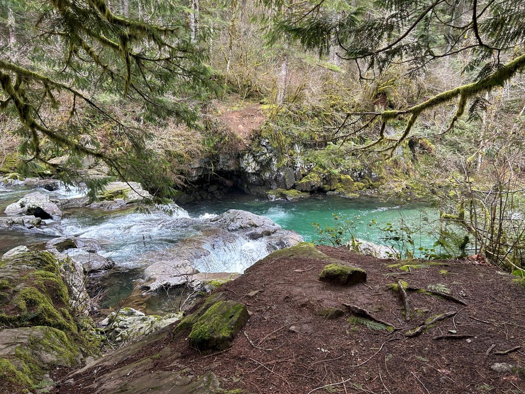
The Sunset Falls campground and day-use area is a great place for a picnic, a hike or just relaxing at the falls. It is located on the forest’s western edge and is easily accessible by car. Visitors can enjoy scenic views of the river and a waterfall, and other recreation opportunities are within a short hike on the Sunset Falls trail.

The short, accessible trail takes you from the Sunset Falls parking lot at the campground and day-use area to the Sunset Falls viewpoint. The trail that leads to the falls is paved and shaded by large evergreen trees. At the end of the trail, there is a large bench overlooking the falls. Because the trail is paved and 40 inches wide, it is accessible for individuals of varying abilities, making it usable for both wheelchairs and walkers. The falls are open year-round and are a popular spot to cool off on summer days. Fishing is not permitted.

The falls are located on the East Fork Lewis River at an elevation of 1,000 feet. Several hiking trails are nearby, including the Silver Star Trail, which provides excellent views. The area is also popular among kayakers visiting the East Fork Lewis River.

The campground is open all year. In the summer, 60% of sites are only available by online reservations. In the off-season, all sites are first-come, first-served.

Toilet Information

  • Toilet at trailhead

More information about toilets

Hike Description Written by
Rod Hooker, WTA Correspondent

Sunset Falls

Map & Directions

Trailhead
Co-ordinates: 45.8188, -122.2506 Open in Google Maps

Before You Go

See weather forecast

Parking Pass/Entry Fee

Northwest Forest Pass

WTA Pro Tip: Save a copy of our directions before you leave! App-based driving directions aren't always accurate and data connections may be unreliable as you drive to the trailhead.

Getting There

From Battle Ground, head north on Hwy 503 for approximately 5.5 miles. Turn right onto NE Rock Creek Road, which will transition into NE 152nd Avenue, then take a slight left onto NE Lucia Falls Road for about 7 miles. Turn right onto NE Sunset Falls Road and continue east for about 7 miles; the parking lot for the falls will be on your right (south), next to the river.

More Hike Details

Trailhead

Southwest Washington > Lewis River Region

Gifford Pinchot National Forest

You can improve or add to this guidebook entry!

Sunset Falls

0 Trip Reports

Hiked here recently?

Submit a trip report!
 
There aren't any trip reports for this hike yet.