Trails for everyone, forever

Home Go Hiking Hiking Guide Sunset Park and Golden Lakes

Sunset Park and Golden Lakes

Mount Rainier Area > NW - Carbon River/Mowich
46.9307, -121.8628 Map & Directions
Length
18.6 miles, roundtrip
Elevation Gain
5,200 feet
Highest Point
5,000 feet
Calculated Difficulty About Calculated Difficulty
Hard
Lakes on the south side of Sunset Park. Photo by urbanefarmboy. Full-size image
  • Wildflowers/Meadows
  • Mountain views
  • Dogs not allowed
  • Established campsites
  • Old growth
  • Lakes
  • Rivers
Saved to My Backpack

The trail to Sunset Park and Golden Lakes is a section of the longer 93-mile Wonderland Trail that can also be hiked as an out-and-back beginning at Mowich Lake. Continue reading

Rating
3.67 out of 5

(6 votes) Log in to rate

Hiking Sunset Park and Golden Lakes

The trail to Sunset Park and Golden Lakes is a section of the longer 93-mile Wonderland Trail that can also be hiked as an out-and-back beginning at Mowich Lake.

Find the trailhead on the south side of the lake, and keep right at the junction with the Wonderland Trail a quarter of a mile in. Prepare your knees for a long descent as you immediately head down a series of long switchbacks toward the Mowich River. After following the river up a ways and crossing via log bridge, you will get to recoup all that lost elevation gain (and then some) with the ascent up to Sunset Park.

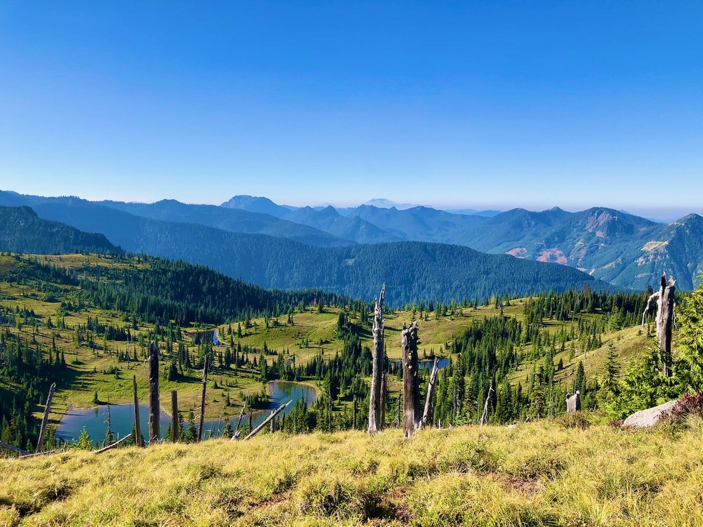
The trail switchbacks up out of the river valley for several miles until reaching a pass where hikers can get a glimpse of their scenic end point. After another mile or two of hugging the hillside, hikers will soon come upon the cluster of lakes known as Golden Lakes.

There is a neat, old ranger cabin alongside the shores of one of the lakes, and a campground just past it. This is a great place to stop for a bite to eat or set up camp (if you have a permit).

Hike Description Written by
Rachel Wendling, WTA Staff

Sunset Park and Golden Lakes

Map & Directions

Trailhead
Co-ordinates: 46.9307, -121.8628 Open in Google Maps

Before You Go

See weather forecast

WTA Pro Tip: Save a copy of our directions before you leave! App-based driving directions aren't always accurate and data connections may be unreliable as you drive to the trailhead.

Getting There

From Puyallup, drive east for 13 miles on Highway 410 to the small town of Buckley. Turn right onto Highway 165 and continue through Carbonado. You're looking for Mowich Lake Road, which is beyond the Carbon River Gorge bridge, right outside of town. Turn right onto Mowich Lake Road and follow it about 17 miles to its end. Note that this road is dirt, and can be rough. Consider bringing a high-clearance vehicle. The trailhead is on the southern end of the lake.

More Hike Details

Trailhead

Mount Rainier Area > NW - Carbon River/Mowich

Mount Rainier National Park

You can improve or add to this guidebook entry!

Sunset Park and Golden Lakes

22 Trip Reports

Hiked here recently?

Submit a trip report!
 
Trip Reports