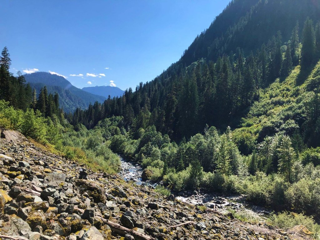

Part of the scenic Pacific Northwest Trail, Swift Creek Trail accesses the Mount Baker Wilderness.
True to its name, this trail features challenging travel cross large and frequently swollen glacier-fed streams, with welcome respites on sections that meander through old-growth forest.
Swift Creek is minimally maintained and may require some route finding, especially through the dense vegetation of steep avalanche slopes. There are no bridges across Rainbow Creek or Swift Creek, so stream fording may be unsafe much of the year -- wait for late summer and the lower water that comes with that season.
From the parking area on Forest Road 1144, hike a quarter mile down the abandoned road turned trail and look for a trail on the left side of the road.
The eight mile trail ends at the extremely popular Lake Ann trail and Heather Meadows beyond.
Swift Creek

-
 Length
- 16.0 miles, roundtrip
-
 Elevation Gain
- 2,700 feet
-
 Highest Point
- 3,930 feet
Part of the scenic Pacific Northwest Trail, rugged 8-mile Swift Creek Trail accesses the Mount Baker Wilderness.
Continue reading
Hiking Swift Creek

WTA worked here in 2024, 2022, 2021, 2020 and 2014!
Map & Directions
 Trailhead
Before You Go
Parking Pass/Entry Fee
NoneWTA Pro Tip: Save a copy of our directions before you leave! App-based driving directions aren't always accurate and data connections may be unreliable as you drive to the trailhead.
Getting There
To access Swift Creek from the south end: From the Mount Baker Ranger District office in Sedro-Woolley, follow State Route 20 east for 16 miles to milepost 82. Turn left (north) on the Baker Lake Highway. Continue 17.7 miles to FR 1130 and turn left. Follow this road for four miles. Turn right and follow FR 1144 to its end. Hike approximately a quarter mile downhill on closed FR 1144 to the trailhead on the left.
It is also possible to access the Swift Creek trail from Lake Ann trail. The junction is 2.3 miles down the trail. However, a Northwest Forest Pass is required here, and this parking lot tends to fill quickly.


