
From the north trailhead for Tatoosh Trail 161, climb 2.5 miles to the signed junction with Tatoosh Lakes Trail 161B. The spur trail is open to hikers only; not even horses are allowed. Head uphill on the Lakes Trail, climbing 150 feet in an eighth of a mile, then cresting over the ridge to a different view of Mount Rainier. Drop steeply down on good trail. There is just one brief section with loose rocks underfoot. A short way down, a sign reads “No camping fire or stock”. Note that this is now true of the entire Lakes basin, not just where the sign is.
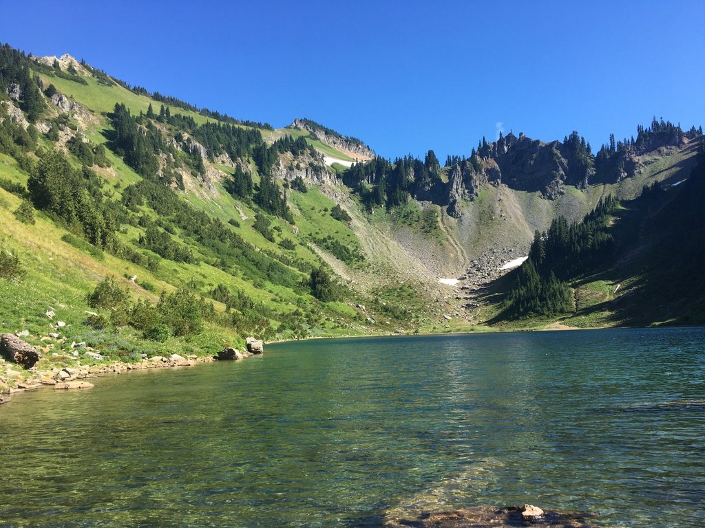
Drop down into Tatoosh Lakes basin at 5150 feet, where the outflow of the chained lakes can be heard gurgling down a small ravine. The trail leads past the two Tatoosh Lakes, which are separated by only 100 feet. Admire the rugged beauty of the cirque that hosts the upper lake. Look at the steep walls due south of that larger lake, and marvel that the original trail down to Tatoosh Lakes wound its way down that slope! (Old maps labeled that path “Dangerous Section”.)
When it is time to leave, return the way you came.
Tatoosh Lakes

-
 Length
- 6.6 miles, roundtrip
-
 Elevation Gain
- 3,400 feet
-
 Highest Point
- 5,750 feet
Parking Pass/Entry Fee
NonePermits Required
Wilderness permit. Self-issue at trailhead (no fee)
Tatoosh Lakes are not open to camping any more, but they are much easier to get to than they used to be, and still a good bet for solitude and the peaceful sounds of nature.
Continue reading
Hiking Tatoosh Lakes

WTA worked here in 2020 and 2019!
Map & Directions
 Trailhead
Before You Go
Parking Pass/Entry Fee
NonePermits Required
Wilderness permit. Self-issue at trailhead (no fee)WTA Pro Tip: Save a copy of our directions before you leave! App-based driving directions aren't always accurate and data connections may be unreliable as you drive to the trailhead.
Getting There
From the eastern end of Packwood, turn north from Highway 12 onto Skate Creek Road S. After four miles, turn right on gravel road FR 5270. The road is little more than one lane wide, and has numerous potholes. At 9.7 miles from U.S. 12, bear right at the ‘Y’ and continue to the trailhead sign “Tatoosh Trail 161” at 11.1 miles. A wide shoulder provides parking for about a dozen vehicles. The trailhead kiosk provides the required self-serve Wilderness Permit, but there are no other amenities.


