Trails for everyone, forever

Home Go Hiking Hiking Guide Tomyhoi Peak

Tomyhoi Peak

North Cascades > Mount Baker Area
48.9436, -121.6619 Map & Directions
Length
13.1 miles, roundtrip
Elevation Gain
4,700 feet
Highest Point
7,294 feet
Calculated Difficulty About Calculated Difficulty
Hard
Mount Shuksan from Tomyhoi summit Full-size image
  • Mountain views
  • Ridges/passes
  • Summits

Parking Pass/Entry Fee

Northwest Forest Pass
Saved to My Backpack

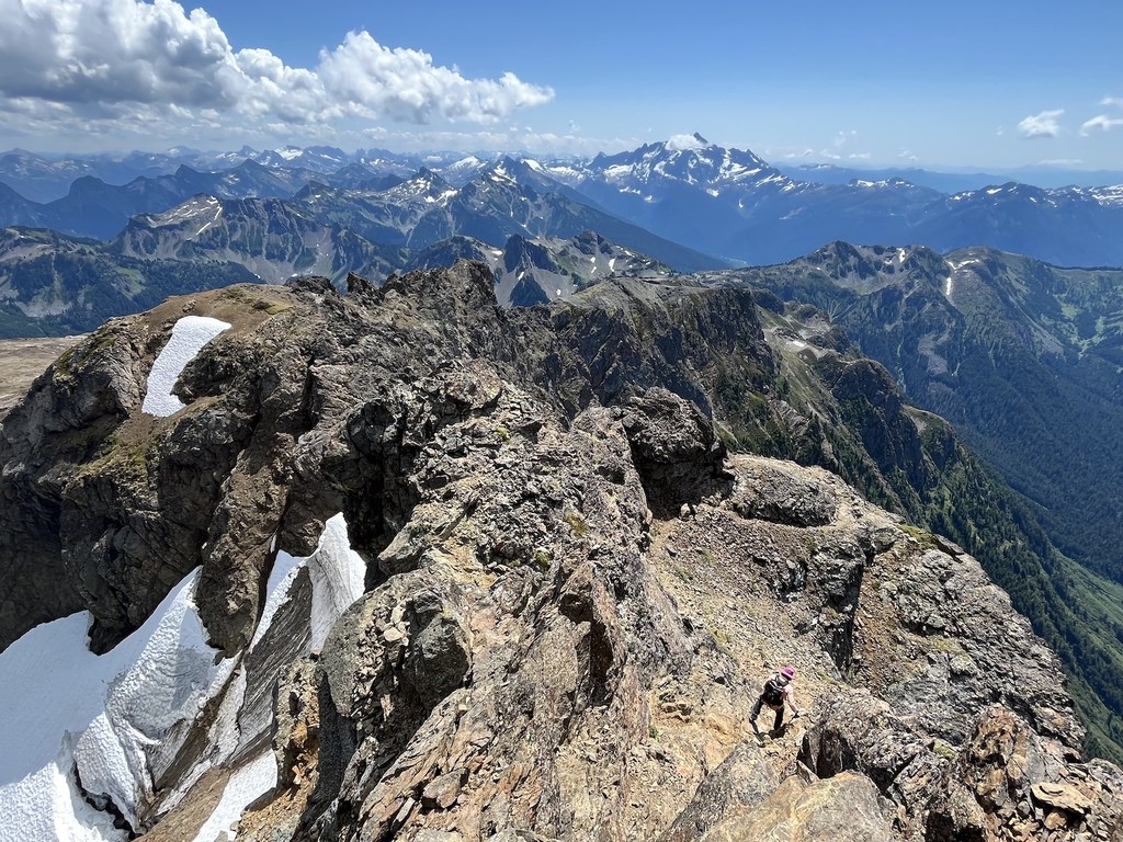
A peak accessible off the Yellow Aster Butte trail, featuring a rock scramble at the end and 360-degree views north to Canada and south to Baker and Shuksan. Continue reading

Rating
3.88 out of 5

(8 votes) Log in to rate

Hiking Tomyhoi Peak

Toilet Information

  • Toilet at trailhead
  • Backcountry privy available

More information about toilets

Tomyhoi Peak

Map & Directions

Trailhead
Co-ordinates: 48.9436, -121.6619 Open in Google Maps

Before You Go

See weather forecast

Parking Pass/Entry Fee

Northwest Forest Pass

WTA Pro Tip: Save a copy of our directions before you leave! App-based driving directions aren't always accurate and data connections may be unreliable as you drive to the trailhead.

More Hike Details

Trailhead

North Cascades > Mount Baker Area

Tomyhoi Peak (#699.1)

Mt. Baker-Snoqualmie National Forest, Mount Baker Ranger District

You can improve or add to this guidebook entry!

Tomyhoi Peak

71 Trip Reports

Hiked here recently?

Submit a trip report!
 
Loading trip reports...
Trip Reports