Trails for everyone, forever

Home Go Hiking Hiking Guide Tongue Mountain

Tongue Mountain

South Cascades > Dark Divide
46.3965, -121.7653 Map & Directions
Length
5.4 miles, roundtrip
Elevation Gain
1,052 feet
Highest Point
4,660 feet
Calculated Difficulty About Calculated Difficulty
Moderate
Phlox on the summit of Tongue Mountain. Photo by 2HuskyHiker. Full-size image
  • Dogs allowed on leash
  • Mountain views
  • Summits
  • Wildflowers/Meadows

Parking Pass/Entry Fee

Northwest Forest Pass
Saved to My Backpack

Tongue Mountain is one of several craggy peaks in the Dark Divide offering excellent views and a nice walk through forest Continue reading

Rating
3.33 out of 5

(12 votes) Log in to rate

Hiking Tongue Mountain

One of several gorgeous peaks in the Dark Divide, Tongue Mountain offers a lovely walk through second-growth forest on a multi-use trail before branching off to a hiker-only trail to access the summit, which is the core of an ancient volcano.

From the trailhead at the saddle, the Tongue Mountain trail climbs Forest Road 2904 for 1 mile to the junction with Tongue Mountain Lookout Trail #294A. Veer right and navigate a 0.7-mile trail to the summit; a core of an extinct volcano.

The hiker-only section of this hike can be pretty steep and almost a scramble near the summit. Hikers who prefer to stay on trail can still get excellent views from the saddle without hiking to the summit.

The Tongue Mountain trail continues past the spur trail to the summit and there are two other ways to access the Tongue Mountain Trail. There is another trailhead at the north end of the trail, on Forest Road 2801, which offers a 4.20 mile approach hike and 2,723 feet of elevation gain. Or, try taking the High Bridge trail, which offers a short, very steep and somewhat rugged approach off the 29 road.

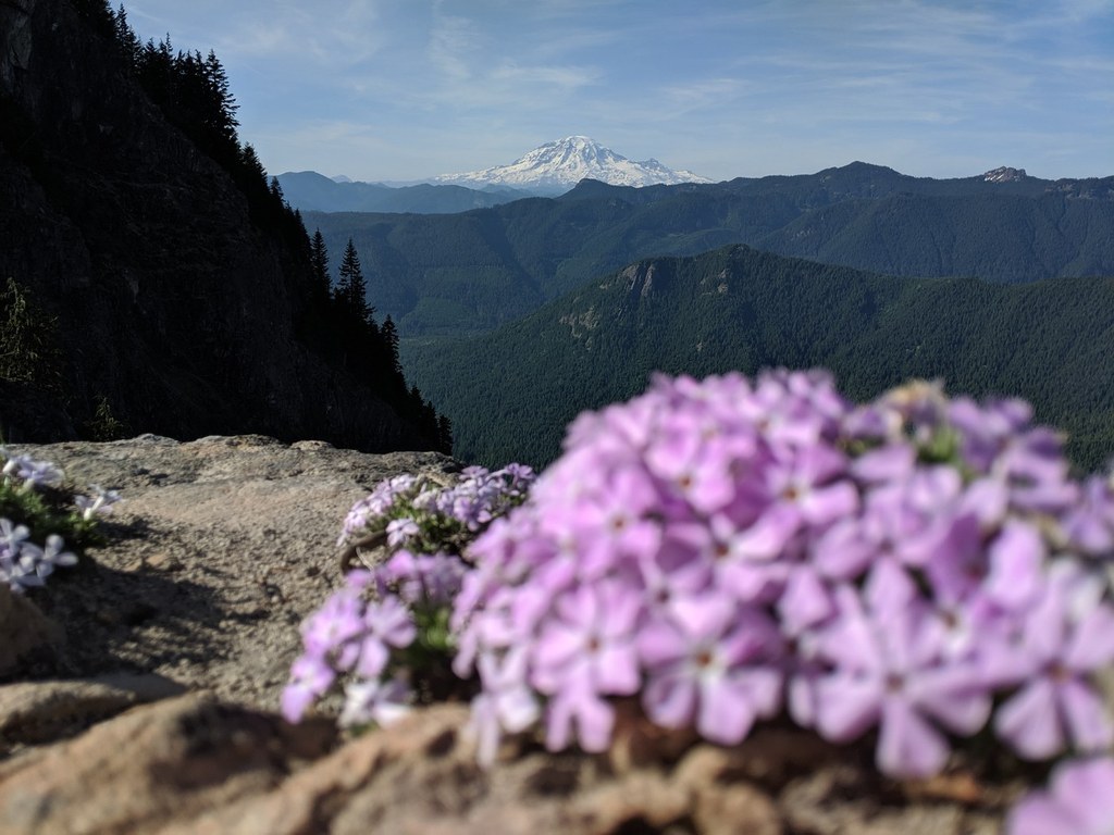
Whichever route you take, the 4,838 foot summit offers excellent views of the Cowlitz Valley District and south to Mount Adams.

Toilet Information

  • No toilet at trailhead

More information about toilets

Hike Description Written by
Anna Roth, WTA Correspondent

Tongue Mountain

Map & Directions

Trailhead
Co-ordinates: 46.3965, -121.7653 Open in Google Maps

Before You Go

See weather forecast

Parking Pass/Entry Fee

Northwest Forest Pass

WTA Pro Tip: Save a copy of our directions before you leave! App-based driving directions aren't always accurate and data connections may be unreliable as you drive to the trailhead.

Getting There

From Randle, travel south on Highway 131. Veer left in 1 mile at the Y of Forest Road 23 and Forest Road 25, staying on Forest Road 23 for 8.1 miles to the junction of Forest Road 28. Stay on Forest Road 28 for 1 mile. Then turn left on Forest Road 29. 

Follow Forest Road 29 for 4.1 miles and turn left on Forest Road 2904 and stay on it for 4.2 miles. Tongue Mountain Trail 294 is across the road from Juniper Ridge Trailhead.

Alternate location

It is also possible to hike Tongue Mountain by starting from High Bridge trail. This trailhead does not have a formal parking area or much of a pullout to stash your car though.

More Hike Details

Trailhead

South Cascades > Dark Divide

Tongue Mountain (#294), High Bridge (#293)

Gifford Pinchot National Forest, Cowlitz Valley Ranger District

Guidebooks & Maps

Day Hiking: South Cascades (Nelson - Mountaineers Books)

Green Trails No. 333 McCoy Peak

Buy the Green Trails McCoy Peak No. 333 map

You can improve or add to this guidebook entry!

Tongue Mountain

42 Trip Reports

Hiked here recently?

Submit a trip report!
 
Trip Reports