Trails for everyone, forever

Home Go Hiking Hiking Guide Toutle Trail
link

Toutle Trail

South Cascades > Mount St. Helens
46.1429, -122.3244 Map & Directions
Length
13.6 miles, one-way
Elevation Gain
1900 feet
Highest Point
4000 feet
Calculated Difficulty About Calculated Difficulty
Hard

The trail is closed until further notice due to wildfire activity.

Mount St. Helens from the Toutle Trail. Photo by Solohiker35. Full-size image
  • Wildflowers/Meadows
  • Ridges/passes
  • Dogs allowed on leash
  • Mountain views
  • Old growth
  • Good for kids
  • Lakes
  • Fall foliage
  • Rivers

The Toutle Trail transects five ecozones over more than 13 miles, but can be done in three sections. Continue reading

Rating
3.00 out of 5

(6 votes) Log in to rate

Hiking Toutle Trail

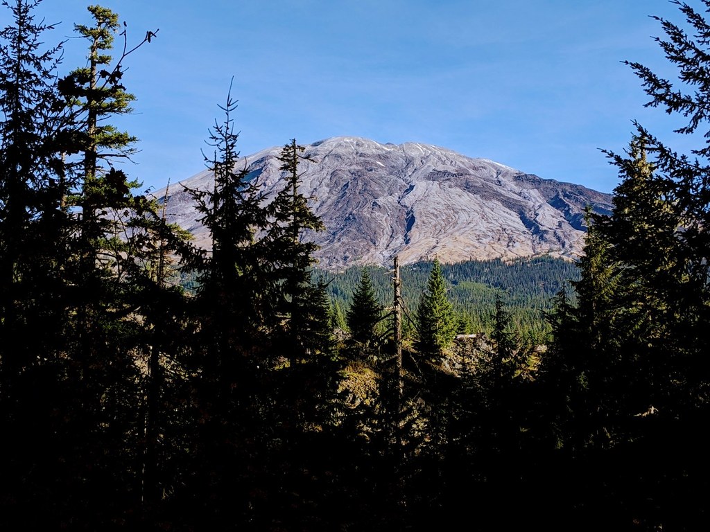
The Toutle Trail transverses five ecozones and is 13.6 miles one way. Like a tree with branches, it connects with eight other Forest Service trails. From the trailhead at Kalama Horse Camp to the end at the Loowit Trail on the south slope of Mount St. Helens, no part of this is trek is too mundane, nor too difficult.

It is the diversity of trail features, dark forests, old growth, and volcano views that makes this a must-hike.  

For more detail on the different sections of this trail check out WTA’s hiking guides for Kalama Horse Camp to Red Rock Pass, Red Rock Pass to Blue Lake Trailhead and Blue Lake Trailhead to Loowit Trail.

WTA worked here in 2014!

Hike Description Written by
Multiple authors contributed to this report, WTA Community

Toutle Trail

Map & Directions

Trailhead
Co-ordinates: 46.1429, -122.3244 Open in Google Maps

Before You Go

The trail is closed until further notice due to wildfire activity.

See weather forecast

WTA Pro Tip: Save a copy of our directions before you leave! App-based driving directions aren't always accurate and data connections may be unreliable as you drive to the trailhead.

Getting There

From the town of Cougar head west on Highway 503 for about 1 mile then turn right onto Forest Road 81. Drive on FR 81 for 8.5 miles, then turn right to stay on FR 81 for 0.2 mile more. Turn right into Kalama Horse Camp Trailhead. This is a campground with a privy.

More Hike Details

Trailhead

South Cascades > Mount St. Helens

Toutle (#238)

Mount St. Helens National Volcanic Monument

Guidebooks & Maps

Day Hiking South Cascades (Dan Nelson - Mountaineers Books)

Mount St. Helens & Mount Adams

National Geographic

Trails Illustrated (c 2014)

Mount St. Helens National Volcanic Monument & Administrative Area: Washington Forest Service

Gifford Pinchot Forest

USDA (2003)

Buy the Green Trails Mount St. Helens NVM No. 332S map

You can improve or add to this guidebook entry

Toutle Trail

9 Trip Reports

Hiked here recently?

Submit a trip report!
 
Trip Reports