Trails for everyone, forever

Home Go Hiking Hiking Guide Trillium Community Forest

Trillium Community Forest

Puget Sound and Islands > Whidbey Island
48.0501, -122.5679 Map & Directions
Length
7.0 miles of trails
Elevation Gain
100 feet
Highest Point
260 feet
Trillium Community Forest Lands. Photo courtesy Whidbey Camano Land Trust.
  • Wildflowers/Meadows
  • Wildlife
  • Dogs allowed on leash
  • Good for kids
  • Lakes
  • Fall foliage

Parking Pass/Entry Fee

None

The 721 forested acres of Trillium Community Forest can be explored by the quiet, meandering trails provided for hiking, horseback riding, and mountain biking. Your path is lined with ferns and soaring stands of Douglas-fir trees. Continue reading

Rating
3.00 out of 5

Hiking Trillium Community Forest

Trillium Community Forest has 721 forested acres that can be explored from the seven miles of trails provided for hiking, horseback riding, and mountain biking. Large areas are protected as a refuge for wildlife. The Land Trust is actively working to improve the habitat quality of the forest. Protection was a joint effort by the Land Trust, community, and Island County.

Since the forest is accessible from three separate parking lots, there are many ways to explore the area. 

Beginning on Pacific Dogwood Trailhead near Highway 525, the first quarter-mile of the trail is along paved road before arriving at a red gate, to the left of the trail Patrick's Way. From here, the trail becomes an old dirt road, where visitors can walk side by side along the wide road bed.

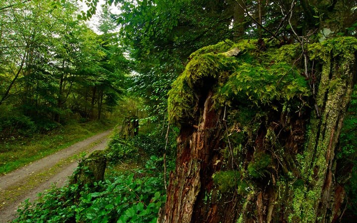
Along the way are ferns lining the path, while Douglas-Fir, hemlock, and pine trees soar above the forest floor. Wildlife abounds here, with the possibility of seeing deer, squirrels, and plenty of flitting birds. The trail heads gradually downhill, in a gentle zigzag through the forest, connecting to various other. Near the intersection with the Crossroad trail a bench lies for some rest under a big maple tree. It's destination leads to the Burkholder trail which ends into private property.

If you're beginning at Smugglers Cove Trailhead, zig zag upward through a dense forest. As you progress your way closer to Patrick's Way, the forest opens and more sunlight comes through.

Beginning at Bounty Loop trailhead, hikers are welcome to use the short and level ADA-accessible loop trail. All users can head down the paved Bounty loop for couple hundred feet, until it opens onto to a dirt path. Bounty connects to Crossroads trail.

Crossroads trail has lots of salal and winding trail lead to more varied trails. Go South to Raven and make a nice loop back using Peaceful Firs or head North to Dragonfly Glades.

There are lots of fun ways to vary your routes here! Be sure to check the map at each trailhead kiosk when you visit, as the trail network is somewhat intricate, and some may dead-end at private property. Maps are also available on the Whidbey Camano Land Trust webite or stop by Greenbank Farm and pick a map from their office.

Seasonal Note: Between October to December, the area is open to hunting and closed to hikers for their safety. Check the website before visiting to ensure the forest is open.

Hike Description Written by
Whidbey Camano Land Trust, WTA Community

Trillium Community Forest

Map & Directions

Trailhead
Co-ordinates: 48.0501, -122.5679 Open in Google Maps

Before You Go

See weather forecast

Parking Pass/Entry Fee

None

WTA Pro Tip: Save a copy of our directions before you leave! App-based driving directions aren't always accurate and data connections may be unreliable as you drive to the trailhead.

Getting There

The Trillium Community Forest has three access points to the forest.

Highway 525 Trailhead
On Whidbey Island, coming from the north or south on Highway 525, turn west on to Pacific Dogwood Lane, 0.9 miles north of Mutiny Bay Road. This parking lot accommodates up to 12 passenger vehicles (under 22 feet in length). Trailer parking is not allowed.

Smugglers Cove Trailhead
On Whidbey Island, coming from the north on Highway 525, turn right onto Smugglers Cove Road, just before Greenbank Farm. Follow Smugglers Cove Rd for 5.2 miles. The parking lot is on the left

Coming from the south on Highway 525, 0.8 miles after Main Street/Fish Road (Freeland), turn left onto Bush Point Road. After 2.2 miles Bush Point Road becomes Smugglers Cove Road. Continue on Smugglers Cove Road for 1.7 miles. The parking lot is on the right, and can accommodate horse trailers, buses, and RVS.

Bounty Loop Trailhead (ADA Accessible)
On Whidbey Island, coming from the north or south on Highway 525, turn west onto Mutiny Bay Road. After 0.3 miles, turn right onto N Bounty Road. Continue another 0.2 miles to the corner of N Bounty Road Bounty Loop. Signs for the parking lot are posted. There are multiple handicapped accessible parking spaces, the lot holds 8 passenger vehicles (under 22 feet in length). Trailer parking is not allowed.

Take Transit:

Island Transit route 56 stops at the intersection of SR 525 and Classic Road, which is 0.9 mile from the trailhead. 

More Hike Details

Trailhead

Puget Sound and Islands > Whidbey Island

Whidbey Camano Land Trust

Guidebooks & Maps

https://www.wclt.org/protected-properties/

You can improve or add to this guidebook entry

Trillium Community Forest

5 Trip Reports

Hiked here recently?

Submit a trip report!
 
Trip Reports