
Perfect roadside hikes suitable for all ages. There is beaver activity among six reconstructed rearing ponds, as well as a meandering river through farm country. Be sure to bring your camera -- there are lots of signs of wildlife, including mink, deer, beaver, and more.
Twisp River Rearing Ponds

-
 Length
- 1.0 miles, roundtrip
-
 Elevation Gain
- 0 feet
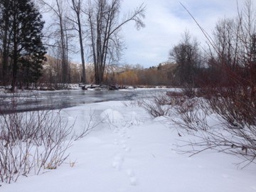
This area is being actively restored to a natural state. A loop hike suitable for all ages winds through wetlands in a critical salmon rearing area.
Continue reading
Hiking Twisp River Rearing Ponds
Twisp River Rearing Ponds
Map & Directions
 Trailhead
Before You Go
WTA Pro Tip: Save a copy of our directions before you leave! App-based driving directions aren't always accurate and data connections may be unreliable as you drive to the trailhead.


