
This excellent early-season romp heads up a lush river canyon boasting three gorgeous waterfalls with riverside campsites for an overnight, or a longer, more challenging loop.
From the trailhead at the end of 5701, descend to a T-junction and turn right (east), heading upstream toward Siouxon Creek (turning left heads downstream and connects to longer Huffman and Siouxon Peak Trails.) Just under a mile along, look for the Horseshoe Ridge trail, breaking off to the right. This 6.9-mile spur climbs to the 3,200-foot viewless crest of Horseshoe Ridge before descending to meet up with the Siouxon Creek trail farther up.
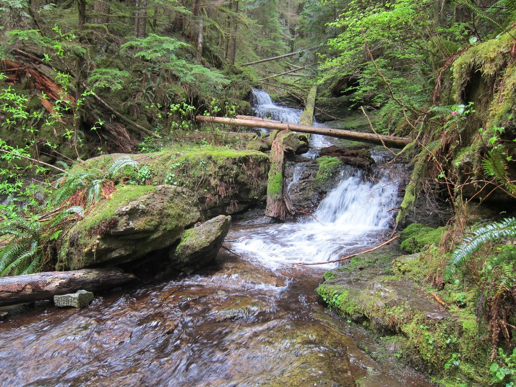
After another half mile, the trail turns slightly south of Siouxon Creek to cross Horseshoe Creek Falls on a sturdy wooden bridge; 60 yards past the falls, look for a spur that descends to a couple of secluded campsites below the falls. A quarter mile farther brings you alongside Siouxon Creek Falls, a 40-foot plunge down a narrow S-shaped cleft. Two campsites and a small, primitive shelter can be found opposite the falls; a short side trail above the falls allows for water access.
Continue up the canyon for 2 more miles to a wide stream cascading across the trail. Use caution on the slick rocks during the early season high runoff. Just beyond the crossing, fork left over another wooden bridge, this time over a deep gorge cut through the rock. Now along Chinook Creek, pass a couple more campsites, and arrive at 50-foot Chinook Creek Falls. A ford is required to connect to the other side of the trail to continue on to Huffman and Siouxon Peaks, so this makes an ideal lunch and turnaround spot below the misty falls.
Horseshoe and Chinook Creek Falls via Upper Siouxon Creek

-
 Length
- 8.4 miles, roundtrip
-
 Elevation Gain
- 700 feet
-
 Highest Point
- 1,570 feet
This excellent early-season romp heads up a lush river canyon boasting three gorgeous waterfalls with riverside campsites for an overnight, or a longer, more challenging loop.
Continue reading
Hiking Horseshoe and Chinook Creek Falls via Upper Siouxon Creek
Horseshoe and Chinook Creek Falls via Upper Siouxon Creek
Map & Directions
 Trailhead
Before You Go
The road is closed beyond the Upper Siouxon Trailhead (Huffman Peak Trailhead) due to wildfire damage. The trail is still accessible via the Upper Siouxon Trailhead.
Parking Pass/Entry Fee
Northwest Forest PassWTA Pro Tip: Save a copy of our directions before you leave! App-based driving directions aren't always accurate and data connections may be unreliable as you drive to the trailhead.


