
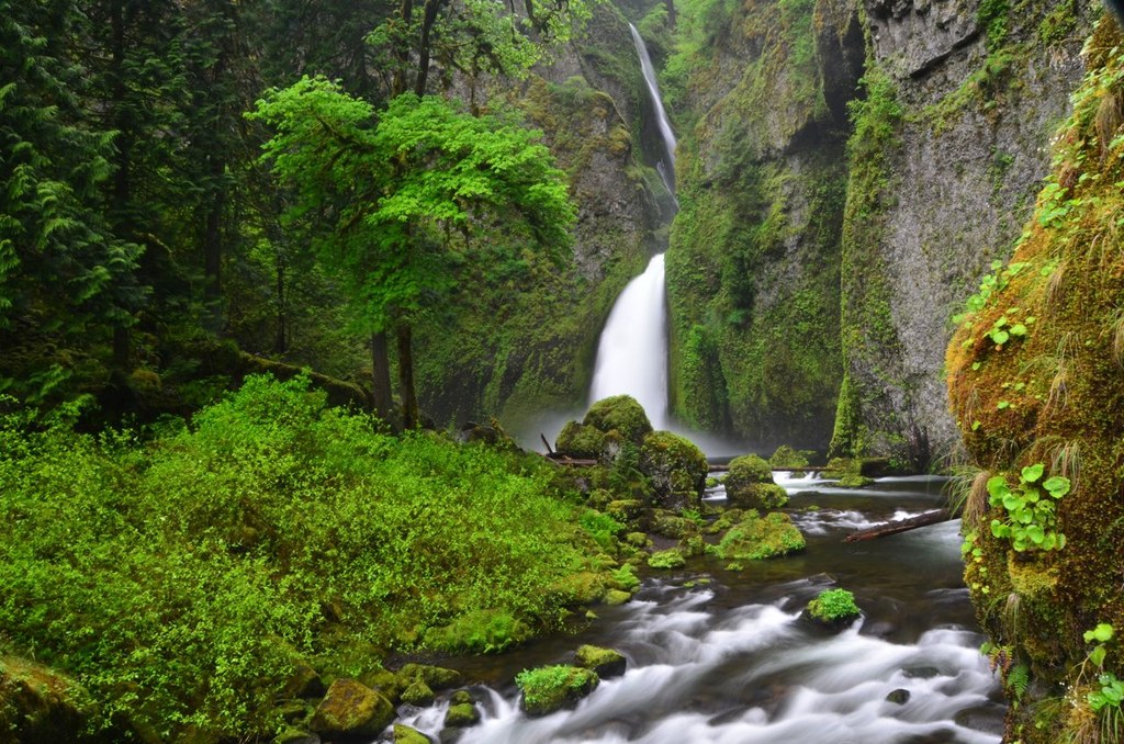

This is a hike to a two-tiered waterfall located in a fairyland grotto with many large moss covered boulders.
Hike this loop by going right at the 0.7 mile junction. This allows you to approach the falls by hiking a trail along Tanner Creek in a wide canyon surrounded by high rock walls and an understory of large moss covered boulders. It is truly a fairyland grotto!
After taking the right trail you soon pass the first bridge over Tanner Creek and begin your gradual ascent into the beautiful amphitheater! As the falls comes into view in the distance you are drawn to continue to the second bridge and an "up close and personal" visit with the falls.
 Trailhead


