

This loop hike brings hikers past some of the best waterfalls in Oregon, offers gorgeous view of the Columbia River, and will get your heart pumping with the steep climb. We recommend you start from the Wahkeena Trailhead, since it's slightly easier to find parking, but if you have secured a timed-entry permit to Multnomah Falls, you can also start there.
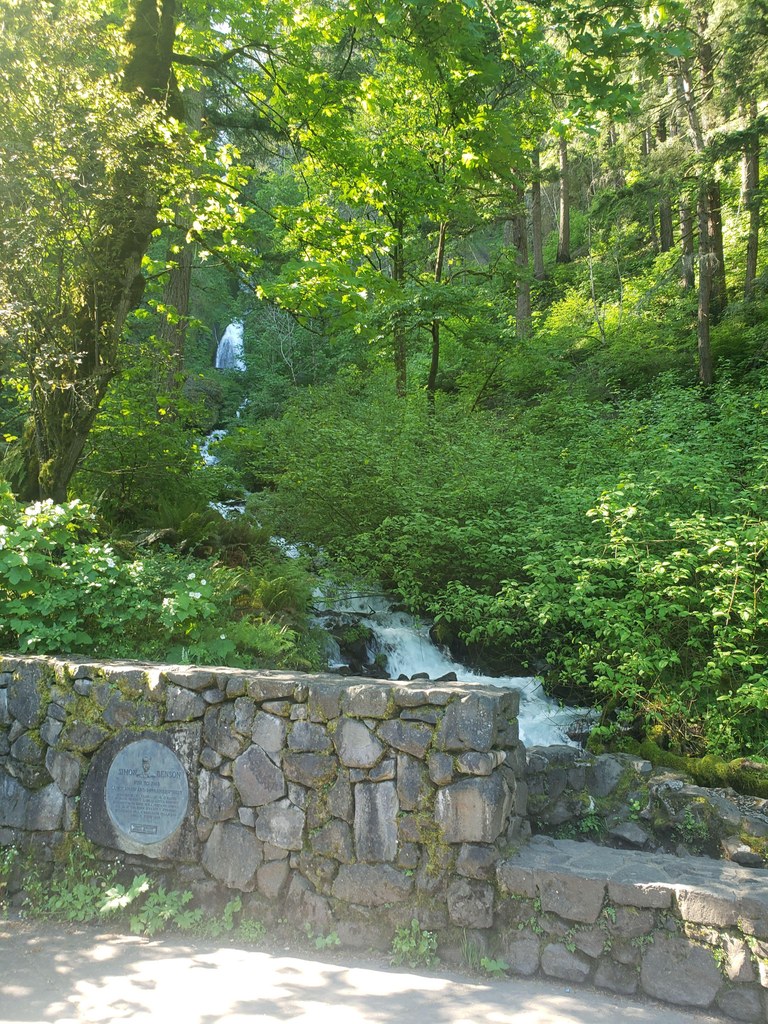
From the Wahkeena Picnic area and trailhead, set off on the paved Wahkeena Trail, pausing briefly at the small viewing platform just off Historic Highway 30. The view of Wahkeena Falls isn't great here, but head up the trail to your right; the view improves in just a few hundred (steep) feet, where the trail crosses a bridge right in front of the impressive waterfall.
Continue up the paved trail as it climbs through several steep switchbacks to a small ridge. To your right, there's a very short detour to tiny Lemmons' Viewpoint. It's not a bad stop, take a small detour to see what's what before turning back towards the creek.
From Lemmons' Viewpoint, the trail dives into open, lush forest and basalt rock formations. The trail is now completely unpaved and dramatic scenery of large rocks, second-growth trees, mossy boulders and birdsong surrounds you as you hike alongside the creek.
At 0.6 miles from the trailhead, arrive at Fairy Falls, a fan-shaped waterfall that photographers love to capture. Snap a pic, and then head up another half mile to a junction. Turning to the left here puts you on the Vista Ridge trail, a 0.7 mile trail that will reconnect to the Wahkeena Trail at small saddle. The Vista Ridge trail includes a lovely view (as the name implies) so you'll likely want to check it out!
The righthand trail ends up at the same place, just with a very slightly shorter length (0.6 miles compared to 0.7). To take it, continue 0.3 miles to another junction, then turn left to stay on the Wahkeena Trail.
The route climbs through a forest, away from the creek and into a quieter environment. The climb moderates as it reaches a saddle where the Vista Ridge Trail rejoins Wahkeena. Hike straight through this saddle, and then take the trail to the left (the right hand trail leads into the Angels - Devils Rest loop.
Now the trail traverses high above the Gorge on a flat to gentle downhill grade. It is a gorgeous section of trail. One benefit of hiking through a former burn is you have extensive views, and the regrowth through here is beautiful. Lush green understory contrasts incredibly with the blackened tree trunks. This traverse only lasts for 0.8 miles before you arrive at an intersection with the Larch Mountain trail.
From this intersection, which features a log bench), turn left. You're now hiking downhill on the Larch Mountain trail. This extensive trail stretches from the base of Multnomah Falls to the summit of Larch Mountain trail, 13 miles away. You're only 0.6 miles away from the Multnomah Falls overlook, and in that stretch of trail you'll pass three other amazing waterfalls in a short amount of time. First is Ecola Falls, followed shortly by Wiesendanger Falls and then Dutchman Falls.
Take the short 0.1 mile detour to the Multnomah Falls overlook, then head back to the paved trail. It's 0.7 miles to the base of Multnomah Falls, and will likely get a bit crowded as you reach the base area.
At the Multnomah Falls base area, you have the chance to use flush toilets before picking up the Return Trail, a short 0.7 mile trail with a small cave and showery waterfall to cap off your loop.
A seasonal note: Wahkeena Falls is open year-round, but mist on this trail in winter can cause the trail to become icy or slippery.
WTA Pro Tip: The picnic area at the base of Wahkeena Falls features picnic tables and restrooms with running water and flush toilets.
 Trailhead


